Khon Kaen Airport: Difference between revisions
Appearance
Content deleted Content added
No edit summary |
No edit summary |
||
| Line 2: | Line 2: | ||
{{More citations needed|date=April 2016}} |
{{More citations needed|date=April 2016}} |
||
{{Infobox airport |
{{Infobox airport |
||
| name = {{nowrap|Khon Kaen International Airport}} |
| name = {{nowrap|Khon Kaen International Airport}} |
||
| nativename = {{lang|th|ท่าอากาศยานขอนแก่น}} |
| nativename = {{lang|th|ท่าอากาศยานขอนแก่น}} |
||
| nativename-a = |
| nativename-a = |
||
| nativename-r = |
| nativename-r = |
||
| image = Khon Kaen airport (24583602473).jpg |
| image = Khon Kaen airport (24583602473).jpg |
||
| image-width = |
| image-width = |
||
| caption = |
| caption = |
||
| IATA = KKC |
| IATA = KKC |
||
| ICAO = VTUK |
| ICAO = VTUK |
||
| type = Public / Military |
| type = Public / Military |
||
| owner = |
| owner = |
||
| operator = [[Department of Airports (Thailand)|Department of Airports]] |
| operator = [[Department of Airports (Thailand)|Department of Airports]] |
||
| city-served = [[Khon Kaen]] |
| city-served = [[Khon Kaen]] |
||
| location = [[Mueang Khon Kaen district|Mueang Khon Kaen]], [[Khon Kaen province|Khon Kaen]], [[Thailand]] |
| location = [[Mueang Khon Kaen district|Mueang Khon Kaen]], [[Khon Kaen province|Khon Kaen]], [[Thailand]] |
||
| opened = {{start date and age|1963|02|06|df=yes|p=n|br=n}} |
| opened = {{start date and age|1963|02|06|df=yes|p=n|br=n}} |
||
| elevation-f = 670 |
| elevation-f = 670 |
||
| elevation-m = 204 |
| elevation-m = 204 |
||
| metric-elev = |
| metric-elev = |
||
| coordinates = {{Coord|16|27|59.86|N|102|47|01.18|E|type:airport|display=inline,title}} |
| coordinates = {{Coord|16|27|59.86|N|102|47|01.18|E|type:airport|display=inline,title}} |
||
| website = |
| website = |
||
| pushpin_map = Thailand |
| pushpin_map = Thailand |
||
| pushpin_map_caption = Location of airport in Thailand |
| pushpin_map_caption = Location of airport in Thailand |
||
| mapframe = yes |
| mapframe = yes |
||
| image_map = {{maplink|frame=yes|plain=yes|type=shape|stroke-width=2|stroke-color=#000000|zoom=13|frame-latitude=16.466628|frame-longitude=102.783661}} |
| image_map = {{maplink|frame=yes|plain=yes|type=shape|stroke-width=2|stroke-color=#000000|zoom=13|frame-latitude=16.466628|frame-longitude=102.783661}} |
||
| pushpin_label = KKC |
| pushpin_label = '''KKC'''/VTUK |
||
| pushpin_label_position = right |
| pushpin_label_position = right |
||
| r1-number = 03/21 |
| r1-number = 03/21 |
||
| r1-length-f = 10,007 |
| r1-length-f = 10,007 |
||
| r1-length-m = 3,050 |
| r1-length-m = 3,050 |
||
| r1-surface = [[Asphalt concrete|Asphalt]] |
| r1-surface = [[Asphalt concrete|Asphalt]] |
||
| metric-rwy = |
| metric-rwy = |
||
| stat-year = 2023 |
| stat-year = 2023 |
||
| stat1-header = Passengers |
| stat1-header = Passengers |
||
| stat1-data = 1,611,393 {{increase}}15.13% |
| stat1-data = 1,611,393 {{increase}}15.13% |
||
| stat2-header = Aircraft movements |
| stat2-header = Aircraft movements |
||
| stat2-data = 10,976 {{increase}}7.54% |
| stat2-data = 10,976 {{increase}}7.54% |
||
| stat3-header = Freight (tonnes) |
| stat3-header = Freight (tonnes) |
||
| stat3-data = 279.2 {{decrease}}3.09% |
| stat3-data = 279.2 {{decrease}}3.09% |
||
| footnotes = Sources: [https://app.powerbi.com/view?r=eyJrIjoiNThhZTJkNzYtOWQ1NC00OWEzLTgwNDctMTliYmU0ZTVhYmI4IiwidCI6IjdhOWZmNDg0LWZiMDctNDI3Zi05Y2QyLWJjMjUzOTU1ZGI0YSIsImMiOjEwfQ%3D%3D Department of Airports] |
| footnotes = Sources: [https://app.powerbi.com/view?r=eyJrIjoiNThhZTJkNzYtOWQ1NC00OWEzLTgwNDctMTliYmU0ZTVhYmI4IiwidCI6IjdhOWZmNDg0LWZiMDctNDI3Zi05Y2QyLWJjMjUzOTU1ZGI0YSIsImMiOjEwfQ%3D%3D Department of Airports] |
||
}} |
}} |
||
Revision as of 05:23, 2 April 2024
This article needs additional citations for verification. (April 2016) |
Khon Kaen International Airport ท่าอากาศยานขอนแก่น | |||||||||||
|---|---|---|---|---|---|---|---|---|---|---|---|
 | |||||||||||
| Summary | |||||||||||
| Airport type | Public / Military | ||||||||||
| Operator | Department of Airports | ||||||||||
| Serves | Khon Kaen | ||||||||||
| Location | Mueang Khon Kaen, Khon Kaen, Thailand | ||||||||||
| Opened | 6 February 1963 | ||||||||||
| Elevation AMSL | 670 ft / 204 m | ||||||||||
| Coordinates | 16°27′59.86″N 102°47′01.18″E / 16.4666278°N 102.7836611°E | ||||||||||
| Maps | |||||||||||
 | |||||||||||
 | |||||||||||
| Runways | |||||||||||
| |||||||||||
| Statistics (2023) | |||||||||||
| |||||||||||
Sources: Department of Airports | |||||||||||
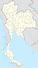
Khon Kaen International Airport (IATA: KKC, ICAO: VTUK) is an airport serving the city of Khon Kaen, the capital city of Khon Kaen province in northeastern Thailand.[1]
Airlines and destinations
| Airlines | Destinations |
|---|---|
| Thai AirAsia | Bangkok–Don Mueang, Chiang Mai, Phuket |
| Thai Airways International | Bangkok–Suvarnabhumi |
| Thai Lion Air | Bangkok–Don Mueang |
| Thai VietJet Air | Bangkok–Suvarnabhumi |
2021 airport upgrade
The airport has seen an annual growth rate of 20 percent annually since 2013, handling around two million passengers in 2017. The Department of Airports (DOA) has signed a memorandum of understanding (MOU) to upgrade Khon Kaen Airport by 2021. The two billion baht project will increase passenger capacity from 2.8 million to five million per year.[2] The terminal will be expanded from 16,500 m2 to 44,500 m2 to accommodate 1,000–2,000 passengers per hour.[3]
Notes
References
- ^ "Khon Kaen Airport". Tourism Authority of Thailand (TAT). Archived from the original on 29 August 2018. Retrieved 29 August 2018.
- ^ Sattaburuth, Aekarach; Jotikasthira, Om (29 August 2018). "Prayut orders airport design contest probe". Bangkok Post. Retrieved 29 August 2018.
- ^ Natanri, Chakkrapan (23 September 2018). "Construction of new Khon Kaen airport terminal begins". Bangkok Post. Retrieved 25 September 2018.
External links
Wikimedia Commons has media related to Khon Kaen Airport.
 Khon Kaen travel guide from Wikivoyage
- Khon Kaen Airport Homepage
- Khon Kaen Airport Facebook Page

Thai Airways international at Khon Kaen Airport


