Pattani Airport: Difference between revisions
Appearance
Content deleted Content added
No edit summary |
No edit summary |
||
| Line 1: | Line 1: | ||
{{Short description|Airport in southern Thailand}} |
{{Short description|Airport in southern Thailand}} |
||
{{Infobox airport |
{{Infobox airport |
||
| name = Pattani Airport |
| name = {{nowrap|Pattani Airport}} |
||
| nativename = |
| nativename = {{lang|th|ท่าอากาศยานปัตตานี}} |
||
| image = <!--airport logo--> |
| image = <!--airport logo--> |
||
| image-width = |
| image-width = |
||
| Line 16: | Line 16: | ||
| pushpin_label_position = right |
| pushpin_label_position = right |
||
| type = Public / Military |
| type = Public / Military |
||
| owner = |
| owner = [[Royal Thai Army]] |
||
| operator = [[Department of Airports (Thailand)|Department of Airports |
| operator = [[Department of Airports (Thailand)|Department of Airports]] |
||
| city-served = [[Pattani, Thailand|Pattani]], [[Pattani province]], [[Thailand]] |
| city-served = [[Pattani, Thailand|Pattani]], [[Pattani province]], [[Thailand]] |
||
| location = |
| location = |
||
| Line 32: | Line 32: | ||
}} |
}} |
||
'''Pattani Airport''' |
'''Pattani Airport''' {{airport codes|PAN|VTSK}} is an [[airport]] serving [[Pattani, Thailand|Pattani]], a town in the [[Pattani province]] of [[southern Thailand]]. |
||
Pattani airport receives flights from the [[Royal Thai Air Force]] supporting counter-[[South Thailand insurgency|insurgency]] operations in the Southern provinces. |
Pattani airport receives flights from the [[Royal Thai Air Force]] supporting counter-[[South Thailand insurgency|insurgency]] operations in the Southern provinces. |
||
Revision as of 05:58, 2 April 2024
Pattani Airport ท่าอากาศยานปัตตานี | |||||||||||
|---|---|---|---|---|---|---|---|---|---|---|---|
 | |||||||||||
| Summary | |||||||||||
| Airport type | Public / Military | ||||||||||
| Owner | Royal Thai Army | ||||||||||
| Operator | Department of Airports | ||||||||||
| Serves | Pattani, Pattani province, Thailand | ||||||||||
| Opened | 1963 | ||||||||||
| Elevation AMSL | 8 ft / 2 m | ||||||||||
| Coordinates | 06°47′08″N 101°09′13″E / 6.78556°N 101.15361°E | ||||||||||
| Maps | |||||||||||
 | |||||||||||
| Runways | |||||||||||
| |||||||||||
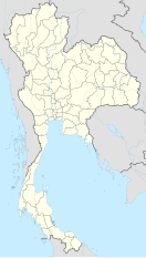
Pattani Airport (IATA: PAN, ICAO: VTSK) is an airport serving Pattani, a town in the Pattani province of southern Thailand.
Pattani airport receives flights from the Royal Thai Air Force supporting counter-insurgency operations in the Southern provinces.
Notes
References
- ^ "VTSK - Pattani Airport". Skyvector.com. Retrieved 7 April 2016.
- ^ "Airline and Airport Code Search". IATA. Retrieved 7 April 2016.
External links
 Pattani travel guide from Wikivoyage

