1935 Shinchiku-Taichū earthquake: Difference between revisions
m →top Tags: Mobile edit Mobile app edit Android app edit |
No edit summary |
||
| Line 18: | Line 18: | ||
| float=right |
| float=right |
||
| caption=}} |
| caption=}} |
||
|magnitude = 7. |
|magnitude = 7.1 {{M|w|link=y}}<ref>{{cite web|title=M 7.1 - Taiwan|url=https://earthquake.usgs.gov/earthquakes/eventpage/iscgem904224#executive|website=earthquake.usgs.gov|access-date=7 February 2018}}</ref> |
||
|depth={{convert|15|km|mi|0|abbr=on}} |
|depth={{convert|15|km|mi|0|abbr=on}} |
||
|location= |
|location= |
||
| Line 29: | Line 29: | ||
}} |
}} |
||
[[File:Longtengbridge.jpg|thumb|300px|The [[Longteng Bridge]] in [[Sanyi, Miaoli|Sanyi]], [[Miaoli County]] collapsed during the Shinchiku-Taichū earthquake.]] |
[[File:Longtengbridge.jpg|thumb|300px|The [[Longteng Bridge]] in [[Sanyi, Miaoli|Sanyi]], [[Miaoli County]] collapsed during the Shinchiku-Taichū earthquake.]] |
||
The '''1935 Shinchiku-Taichū earthquake''' occurred with a [[Richter magnitude scale|Richter magnitude]] of 7.1 (7. |
The '''1935 Shinchiku-Taichū earthquake''' occurred with a [[Richter magnitude scale|Richter magnitude]] of 7.1 (7.1 [[Moment magnitude scale|M<sub>w</sub>]]) in April 1935 with its epicenter in [[Taichung]], Taiwan (then [[Shinchiku Prefecture]]). It was the [[List of earthquakes in Taiwan|deadliest earthquake in Taiwan's recorded history]], claiming 3,276 lives and causing extensive damage. Twelve seconds after the mainshock, an aftershock of {{M|l|link=y}} 6.0 occurred, centered on ''Gabi Village'' (present-day [[Emei, Hsinchu|Emei Township]], [[Hsinchu County]]). |
||
==Earthquake== |
==Earthquake== |
||
Revision as of 06:39, 4 April 2024
 | |
| UTC time | 1935-04-20 22:02:01 |
|---|---|
| ISC event | 904224 |
| USGS-ANSS | ComCat |
| Local date | 21 April 1935 |
| Local time | 06:02:01 |
| Magnitude | 7.1 Mw[1] |
| Depth | 15 km (9 mi) |
| Epicenter |
|
| Areas affected | Japanese Taiwan |
| Max. intensity | MMI VIII (Severe) |
| Casualties | 3,276 killed, 12,053+ injured |

The 1935 Shinchiku-Taichū earthquake occurred with a Richter magnitude of 7.1 (7.1 Mw) in April 1935 with its epicenter in Taichung, Taiwan (then Shinchiku Prefecture). It was the deadliest earthquake in Taiwan's recorded history, claiming 3,276 lives and causing extensive damage. Twelve seconds after the mainshock, an aftershock of ML 6.0 occurred, centered on Gabi Village (present-day Emei Township, Hsinchu County).
Earthquake
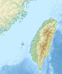
The initial shock happened at 06:02 local time on 21 April 1935. The epicentre was in the village of Sansa (三叉), Byōritsu District, Shinchiku Prefecture (modern-day Sanyi, Miaoli), with the quake measuring 7.1 on the Richter magnitude scale. The quake was felt all over Taiwan apart from Hengchun on the southern tip of the island, as well as in Fuzhou and Xiamen, China, across the Taiwan Strait.[2] Soil liquefaction was observed in various locations, and a 3 m (10 ft) drop between the two sides of the fault was in evidence at Gabi Village.[3] The most serious damage from the quake was located in Shinchiku Prefecture and Taichū Prefecture (present-day Miaoli County and Taichung) over a 135 square kilometres (52 sq mi) area.[2]
A number of aftershocks followed the main quake, with the largest registering 6.0 with an epicentre at Gabi.
Damage
The earthquake was the deadliest in Taiwan's recorded history. The official reports cite the following figures for deaths, injuries and damage:
- Deaths: 3,276
- Injuries: 12,053
- Houses destroyed: 17,907
- Houses damaged: 36,781
The infrastructure of the island also sustained severe damage, with transportation, communications, and water networks heavily compromised.[4]
Reported portents
Residents in central Taiwan reported that several days before the earthquake there were "signs in the sky" of impending disaster, while locals from Kiyomizu Town, Taichū Prefecture (modern-day Qingshui, Taichung) near the epicentre, reported water boiling in ground wells an hour before the shock.[5]
Response
The great number of casualties in the earthquake prompted a review of safety standards, with the colonial Japanese government implementing building codes of a similar standard to those in force in Japan in the wake of the disaster.[4] Locals were apparently appreciative of the efforts of Japanese policemen in recovering bodies, given local superstitions against touching the dead.[4]
See also
Notes
- ^ "M 7.1 - Taiwan". earthquake.usgs.gov. Retrieved 7 February 2018.
- ^ a b Sen & Wu (1996), p. 18.
- ^ 1935年新竹-台中地震 [The 1935 Hsinchu-Taichung Earthquake] (in Chinese). Central Weather Bureau. Archived from the original on 2009-02-12. Retrieved 2009-08-08.
- ^ a b c Hsieh, Catherine (26 Oct 2001). "The historical impact of earthquake damage on Taiwan society and culture". Taiwan Journal. Archived from the original on 2016-07-01. Retrieved 2009-07-21.
- ^ Sen & Wu (1996), p. 17.
References
- Sen, Xuanxiong; Wu, Ruiyun (1996). 台灣大地震:1935年中部大震災紀實 [Great Taiwan Earthquake: The 1935 Central Taiwan Earthquake Disaster Report]. Taipei: Yuan Liou. ISBN 957-32-2793-2.
External links
- The International Seismological Centre has a bibliography and/or authoritative data for this event.

