Foindle: Difference between revisions
Appearance
Content deleted Content added
added link |
Tagishsimon (talk | contribs) redo coords based on https://maps.nls.uk/geo/explore/#zoom=15.0&lat=58.38665&lon=-5.10297&layers=6&b=10&o=8&marker=58.387401,-5.097947 |
||
| Line 11: | Line 11: | ||
|os_grid_reference= NC189493 |
|os_grid_reference= NC189493 |
||
|map_type=Sutherland |
|map_type=Sutherland |
||
|coordinates = {{coord|58. |
|coordinates = {{coord|58.38740|-5.09795|display=inline,title}} |
||
|unitary_scotland= [[Highland (council area)|Highland]] |
|unitary_scotland= [[Highland (council area)|Highland]] |
||
|lieutenancy_scotland=[[Sutherland]] |
|lieutenancy_scotland=[[Sutherland]] |
||
Revision as of 18:12, 19 June 2024
| Foindle | |
|---|---|
 Traigh Bad na Baighe The bay at close to high water. Foinaven and Arkle can be seen in the distance. | |
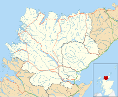
Location within the Sutherland area | |
| OS grid reference | NC189493 |
| Council area | |
| Lieutenancy area | |
| Country | Scotland |
| Sovereign state | United Kingdom |
| Postcode district | IV27 4 |
| Police | Scotland |
| Fire | Scottish |
| Ambulance | Scottish |
Foindle (Template:Lang-gd) is a village on the south shore of Loch Laxford in Lairg, Sutherland, Scottish Highlands and is in the Scottish council area of Highland.[1]
The village of Fanagmore is located 0.5 miles to the west, and sit in the same cove.
References
- ^ Warren Rovetch (2002). The Creaky Traveler in the North West Highlands of Scotland: A Journey for the Mobile But Not Agile. Sentient Publications. p. 91. ISBN 978-0-9710786-7-3.

