Talsint: Difference between revisions
Appearance
Content deleted Content added
Tom.Reding (talk | contribs) m +{{Authority control}} (1 ID from Wikidata); WP:GenFixes & cleanup on |
Salmoonlight (talk | contribs) No edit summary |
||
| Line 1: | Line 1: | ||
{{Infobox settlement |
{{Infobox settlement |
||
<!--See the Table at Infobox Settlement for all fields and descriptions of usage--> |
|||
<!-- Basic info ----------------> |
|||
|official_name = Talsint |
|official_name = Talsint |
||
| ⚫ | |||
|other_name = |
|other_name = |
||
|native_name = <!-- for cities whose native name is not in English --> |
|native_name = <!-- for cities whose native name is not in English --> |
||
| Line 9: | Line 6: | ||
|settlement_type =Rural commune |
|settlement_type =Rural commune |
||
|motto = |
|motto = |
||
| ⚫ | |||
<!-- images and maps -----------> |
|||
|image_skyline = |
|||
|imagesize = |
|imagesize = |
||
|image_caption = |
|image_caption = LMAN-yallah, heading to Talsint |
||
|image_flag = |
|image_flag = |
||
|flag_size = |
|flag_size = |
||
| Line 32: | Line 28: | ||
|subdivision_type3 = |
|subdivision_type3 = |
||
|subdivision_name3 = |
|subdivision_name3 = |
||
<!-- Politics -----------------> |
|||
|government_footnotes = |
|government_footnotes = |
||
|government_type = |
|government_type = |
||
| Line 39: | Line 34: | ||
|established_title = <!-- Settled --> |
|established_title = <!-- Settled --> |
||
|established_date = |
|established_date = |
||
<!-- Area ---------------------> |
|||
|area_magnitude = |
|area_magnitude = |
||
|unit_pref =Imperial <!--Enter: Imperial, if Imperial (metric) is desired--> |
|unit_pref =Imperial <!--Enter: Imperial, if Imperial (metric) is desired--> |
||
| Line 45: | Line 39: | ||
|area_total_km2 = |
|area_total_km2 = |
||
|area_land_km2 = <!--See table @ Template:Infobox Settlement for details on automatic unit conversion--> |
|area_land_km2 = <!--See table @ Template:Infobox Settlement for details on automatic unit conversion--> |
||
<!-- Population -----------------------> |
|||
|population_as_of = 2014 |
|population_as_of = 2014 |
||
|population_footnotes =<ref name=census2014>{{cite web |url=http://rgph2014.hcp.ma/file/166326/ |title=POPULATION LÉGALE DES RÉGIONS, PROVINCES, PRÉFECTURES, MUNICIPALITÉS, ARRONDISSEMENTS ET COMMUNES DU ROYAUME D’APRÈS LES RÉSULTATS DU RGPH 2014 |language=ar, fr |publisher=[[Haut Commissariat au Plan|High Commission for Planning, Morocco]] |date=8 April 2015 |accessdate=29 September 2017}}</ref> |
|population_footnotes =<ref name=census2014>{{cite web |url=http://rgph2014.hcp.ma/file/166326/ |title=POPULATION LÉGALE DES RÉGIONS, PROVINCES, PRÉFECTURES, MUNICIPALITÉS, ARRONDISSEMENTS ET COMMUNES DU ROYAUME D’APRÈS LES RÉSULTATS DU RGPH 2014 |language=ar, fr |publisher=[[Haut Commissariat au Plan|High Commission for Planning, Morocco]] |date=8 April 2015 |accessdate=29 September 2017}}</ref> |
||
|population_note = |
|population_note = |
||
|population_total = |
|population_total =16,166 |
||
|population_urban = |
|population_urban =9,079 |
||
|population_density_km2 = |
|population_density_km2 = |
||
<!-- General information ---------------> |
|||
|timezone = [[Western European Time|WET]] |
|timezone = [[Western European Time|WET]] |
||
|utc_offset = +0 |
|utc_offset = +0 |
||
|timezone_DST = [[Western European Summer Time|WEST]] |
|timezone_DST = [[Western European Summer Time|WEST]] |
||
|utc_offset_DST = +1 |
|utc_offset_DST = +1 |
||
|coordinates = |
|coordinates = {{Coord|32.539847|-3.440805|display=inline,title|region:MA_type:city_source:GNS-enwiki}} |
||
|elevation_footnotes = <!--for references: use <ref> tags--> |
|elevation_footnotes = <!--for references: use <ref> tags--> |
||
|elevation_m = |
|elevation_m = |
||
|elevation_ft = <!-- accord. to Google Earth--> |
|elevation_ft = <!-- accord. to Google Earth--> |
||
<!-- Area/postal codes & others --------> |
|||
|postal_code_type = <!-- enter ZIP code, Postcode, Post code, Postal code... --> |
|postal_code_type = <!-- enter ZIP code, Postcode, Post code, Postal code... --> |
||
|postal_code = |
|postal_code = |
||
| Line 70: | Line 61: | ||
|footnotes = |
|footnotes = |
||
}} |
}} |
||
'''Talsint''' is a town and rural commune in [[Figuig Province]], [[Oriental (Morocco)|Oriental]], [[Morocco]]. According to the 2004 census, it had a population of 7,098.<ref>{{cite web|url=http://www.world-gazetteer.com/wg.php?x=1248939396&men=gcis&lng=en&des=wg&geo=-6467&srt=npan&col=adhoq&msz=1500|title=World Gazetteer|url-status=dead|archiveurl=https://archive.today/20120919014149/http://www.world-gazetteer.com/wg.php?x=1248939396&men=gcis&lng=en&des=wg&geo=-6467&srt=npan&col=adhoq&msz=1500|archivedate=19 September 2012}}</ref> |
'''Talsint''' is a town and rural commune in [[Figuig Province]], [[Oriental (Morocco)|Oriental]], [[Morocco]]. According to the 2004 census, it had a population of 7,098.<ref>{{cite web|url=http://www.world-gazetteer.com/wg.php?x=1248939396&men=gcis&lng=en&des=wg&geo=-6467&srt=npan&col=adhoq&msz=1500|title=World Gazetteer|url-status=dead|archiveurl=https://archive.today/20120919014149/http://www.world-gazetteer.com/wg.php?x=1248939396&men=gcis&lng=en&des=wg&geo=-6467&srt=npan&col=adhoq&msz=1500|archivedate=19 September 2012}}</ref> |
||
| Line 80: | Line 70: | ||
{{Oriental (Morocco)}} |
{{Oriental (Morocco)}} |
||
{{Authority control}} |
{{Authority control}} |
||
{{Coord|32.539847|-3.440805|display=title|region:MA_type:city_source:GNS-enwiki}} |
|||
[[Category:Populated places in Oriental (Morocco)]] |
[[Category:Populated places in Oriental (Morocco)]] |
||
Latest revision as of 09:14, 18 August 2024
Talsint | |
|---|---|
Rural commune | |
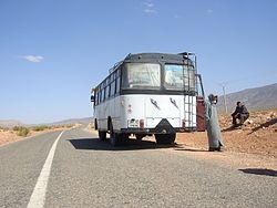
 LMAN-yallah, heading to Talsint | |
 | |
| Coordinates: 32°32′23″N 3°26′27″W / 32.539847°N 3.440805°W | |
| Country | |
| Region | Oriental |
| Province | Figuig |
| Population (2014)[1] | |
• Rural commune | 16,166 |
| • Urban | 9,079 |
| Time zone | UTC+0 (WET) |
| • Summer (DST) | UTC+1 (WEST) |
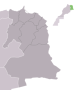
Talsint is a town and rural commune in Figuig Province, Oriental, Morocco. According to the 2004 census, it had a population of 7,098.[2]
Talsint enjoyed huge media coverage in Morocco, when on 20 August 2000, King Mohammed VI announced the discovery of substantial quantities of oil and natural gas reserves in the region.[3] Further research revealed this to be untrue.
References
[edit]- ^ "POPULATION LÉGALE DES RÉGIONS, PROVINCES, PRÉFECTURES, MUNICIPALITÉS, ARRONDISSEMENTS ET COMMUNES DU ROYAUME D'APRÈS LES RÉSULTATS DU RGPH 2014" (in Arabic and French). High Commission for Planning, Morocco. 8 April 2015. Retrieved 29 September 2017.
- ^ "World Gazetteer". Archived from the original on 19 September 2012.
- ^ "Portail national du Maroc : Discours de S.M. le Roi Mohammed VI à l'occasion du 47ème anniversaire de la Révolution du Roi et du Peuple et du 37ème anniversaire du Souverain. 20/08/2000". Maroc.ma. Archived from the original on 1 September 2006. Retrieved 12 September 2012.

