Krnice, Hrastnik: Difference between revisions
Appearance
Content deleted Content added
→External links: updated link |
Tom.Reding (talk | contribs) |
||
| Line 109: | Line 109: | ||
|footnotes = <ref>[http://www.stat.si/eng/index.asp Statistical Office of the Republic of Slovenia] {{webarchive |url=https://web.archive.org/web/20081118142042/http://www.stat.si/eng/index.asp |date=November 18, 2008 }}</ref>}} |
|footnotes = <ref>[http://www.stat.si/eng/index.asp Statistical Office of the Republic of Slovenia] {{webarchive |url=https://web.archive.org/web/20081118142042/http://www.stat.si/eng/index.asp |date=November 18, 2008 }}</ref>}} |
||
'''Krnice''' ({{IPA |
'''Krnice''' ({{IPA|sl|kəɾˈniːtsɛ|pron}}) is a settlement in the [[Municipality of Hrastnik]] in central [[Slovenia]]. It lies in the hills above the left bank of the [[Sava|Sava River]]. The area is part of the traditional region of [[Lower Styria|Styria]]. It is now included with the rest of the municipality in the [[Central Sava Statistical Region]].<ref>[http://www.hrastnik.si Hrastnik municipal site]</ref> |
||
==References== |
==References== |
||
Latest revision as of 15:18, 23 August 2024
Krnice | |
|---|---|
| Coordinates: 46°7′8.65″N 15°6′41.04″E / 46.1190694°N 15.1114000°E | |
| Country | |
| Traditional region | Styria |
| Statistical region | Central Sava |
| Municipality | Hrastnik |
| Area | |
• Total | 1.59 km2 (0.61 sq mi) |
| Elevation | 456.2 m (1,496.7 ft) |
| Population (2002) | |
• Total | 114 |
| [1] | |
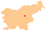
Krnice (pronounced [kəɾˈniːtsɛ]) is a settlement in the Municipality of Hrastnik in central Slovenia. It lies in the hills above the left bank of the Sava River. The area is part of the traditional region of Styria. It is now included with the rest of the municipality in the Central Sava Statistical Region.[2]
References
[edit]- ^ Statistical Office of the Republic of Slovenia Archived November 18, 2008, at the Wayback Machine
- ^ Hrastnik municipal site
External links
[edit]


