Nokaneng Airport: Difference between revisions
Appearance
Content deleted Content added
m –{{Botswana-stub}} using StubSorter |
→External links: rm external links redundant to coordinates |
||
| Line 64: | Line 64: | ||
==External links== |
==External links== |
||
*[https://www.openstreetmap.org/#map=13/-19.6908/22.2031 OpenStreetMap - Nokaneng] |
|||
*[http://ourairports.com/airports/FBNN/pilot-info.html#general OurAirports - Nokaneng] |
*[http://ourairports.com/airports/FBNN/pilot-info.html#general OurAirports - Nokaneng] |
||
*[http://www.fallingrain.com/icao/FBNN.html Fallingrain - Nokaneng Airport] |
*[http://www.fallingrain.com/icao/FBNN.html Fallingrain - Nokaneng Airport] |
||
Revision as of 16:33, 25 September 2024
Nokaneng Airport | |||||||||||
|---|---|---|---|---|---|---|---|---|---|---|---|
| Summary | |||||||||||
| Operator | Civil Aviation Authority of Botswana | ||||||||||
| Serves | Nokaneng, Botswana | ||||||||||
| Elevation AMSL | 3,145 ft / 959 m | ||||||||||
| Coordinates | 19°40′50″S 22°11′57″E / 19.68056°S 22.19917°E | ||||||||||
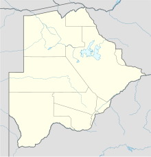
| Map | |||||||||||
 | |||||||||||
| Runways | |||||||||||
| |||||||||||
Nokaneng Airport (ICAO: FBNN) is an airport serving the village of Nokaneng on the western edge of the Okavango Delta in Botswana. The runway is 2 kilometres (1.2 mi) southeast of the village.
See also
References
- ^ Airport information for Nokaneng Airport at Great Circle Mapper.
- ^ Google Maps - Nokaneng
External links
- OurAirports - Nokaneng
- Fallingrain - Nokaneng Airport
- Accident history for Nokaneng Airport at Aviation Safety Network

