Vitebsk (air base): Difference between revisions
Appearance
Content deleted Content added
Tom.Reding (talk | contribs) m WP:STUBSPACING followup |
→top: Image: Satellite imagery of the former Vitebsk air base |
||
| Line 4: | Line 4: | ||
| nativename-a = |
| nativename-a = |
||
| nativename-r = |
| nativename-r = |
||
| image = NASA FIRMS 2024-10-13 Vitebsk.png |
|||
| caption = Satellite imagery of the former Vitebsk air base |
|||
| IATA = |
| IATA = |
||
| ICAO = XMNW |
| ICAO = XMNW |
||
Revision as of 20:50, 13 October 2024
Vitebsk-North | |||||||||||
|---|---|---|---|---|---|---|---|---|---|---|---|
 Satellite imagery of the former Vitebsk air base | |||||||||||
| Summary | |||||||||||
| Airport type | Military | ||||||||||
| Location | Vitebsk | ||||||||||
| Elevation AMSL | 636 ft / 194 m | ||||||||||
| Coordinates | 55°15′18″N 030°14′48″E / 55.25500°N 30.24667°E | ||||||||||
| Map | |||||||||||
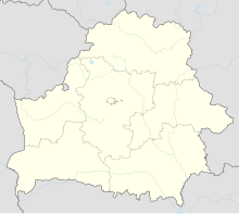
Location of airport in Belarus | |||||||||||
 | |||||||||||
| Runways | |||||||||||
| |||||||||||
Vitebsk (also Vitebsk Northeast or Andronovichi) is a former air base in northern Belarus located 8 km northeast of the city of Vitebsk. It was a small airfield complex with a large single tarmac. In Soviet times it was home to the 339th Military Air Transport Regiment (339 VTAP) flying 32 Ilyushin Il-76 cargo jets as well as Antonov An-22 planes.[1]
The regiment was disbanded in 1996.
References
- ^ "37 Vozdushnaya Armiya VGK". Brinkster.com. Archived from the original on 25 May 2007.


