Tauginiškiai: Difference between revisions
Appearance
Content deleted Content added
stub sort |
|||
| Line 21: | Line 21: | ||
|coordinates = {{coord|55|22|13|N|23|40|48|E|region:LT|display=inline,title}} |
|coordinates = {{coord|55|22|13|N|23|40|48|E|region:LT|display=inline,title}} |
||
}} |
}} |
||
'''Tauginiškiai''' (formerly {{ |
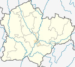
'''Tauginiškiai''' (formerly {{langx|ru|Товгенишки}}, {{langx|pl|Towgianiszki, Towgieniszki}})<ref name=SgKP/> is a village in [[Kėdainiai district municipality]], in [[Kaunas County]], in central [[Lithuania]]. According to the 2011 census, the village was uninhabited.<ref name=census/> It is located {{convert|2|km}} from [[Pajieslys]], by the Paropėlė rivulet. |
||
==History== |
==History== |
||
Latest revision as of 16:33, 26 October 2024
Tauginiškiai | |
|---|---|
Village | |
| Coordinates: 55°22′13″N 23°40′48″E / 55.37028°N 23.68000°E | |
| Country | |
| County | |
| Municipality | Kėdainiai district municipality |
| Eldership | Krakės Eldership |
| Population (2011) | |
• Total | 0 |
| Time zone | UTC+2 (EET) |
| • Summer (DST) | UTC+3 (EEST) |
Tauginiškiai (formerly Russian: Товгенишки, Polish: Towgianiszki, Towgieniszki)[1] is a village in Kėdainiai district municipality, in Kaunas County, in central Lithuania. According to the 2011 census, the village was uninhabited.[2] It is located 2 kilometres (1.2 mi) from Pajieslys, by the Paropėlė rivulet.
History
[edit]At the end of the 19th century there was a manor of the Račkauskai family.[1]
Demography
[edit]
|
| ||||||||||||||||||||||||||||||
| Source: 1902, 1923, 1959 & 1970, 1979, 1989, 2001, 2011 | |||||||||||||||||||||||||||||||
References
[edit]- ^ a b "Towgieniszki". Geographical Dictionary of the Kingdom of Poland (in Polish). 12. Warszawa: Kasa im. Józefa Mianowskiego. 1892. p. 439. , "Towgianiszki". Geographical Dictionary of the Kingdom of Poland (in Polish). 15 pt. 2. Warszawa: Kasa im. Józefa Mianowskiego. 1902. p. 662.
- ^ "2011 census". Statistikos Departamentas (Lithuania). Retrieved August 21, 2017.


