Netolice: Difference between revisions
RodRabelo7 (talk | contribs) |
|||
| Line 54: | Line 54: | ||
| footnotes = |
| footnotes = |
||
}} |
}} |
||
'''Netolice''' ({{IPA|cs|ˈnɛtolɪtsɛ}}; {{ |
'''Netolice''' ({{IPA|cs|ˈnɛtolɪtsɛ}}; {{langx|de|Netolitz}}) is a town in [[Prachatice District]] in the [[South Bohemian Region]] of the [[Czech Republic]]. It has about 2,500 inhabitants. The historic town centre is well preserved and is protected by law as an [[Cultural monument (Czech Republic)#Monument zones|urban monument zone]]. |
||
==Administrative parts== |
==Administrative parts== |
||
Revision as of 22:31, 26 October 2024
Netolice | |
|---|---|
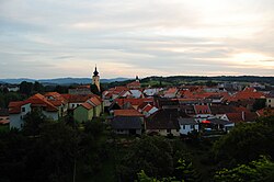
 Panorama of Netolice | |
| Coordinates: 49°2′58″N 14°11′49″E / 49.04944°N 14.19694°E | |
| Country | |
| Region | South Bohemian |
| District | Prachatice |
| First mentioned | 981 |
| Government | |
| • Mayor | Vladimír Pešek |
| Area | |
• Total | 26.35 km2 (10.17 sq mi) |
| Elevation | 432 m (1,417 ft) |
| Population (2024-01-01)[1] | |
• Total | 2,498 |
| • Density | 95/km2 (250/sq mi) |
| Time zone | UTC+1 (CET) |
| • Summer (DST) | UTC+2 (CEST) |
| Postal code | 384 11 |
| Website | www |
Netolice (Czech pronunciation: [ˈnɛtolɪtsɛ]; German: Netolitz) is a town in Prachatice District in the South Bohemian Region of the Czech Republic. It has about 2,500 inhabitants. The historic town centre is well preserved and is protected by law as an urban monument zone.
Administrative parts
The village of Petrův Dvůr is an administrative part of Netolice.
Etymology
The name is derived from the personal name Netol, meaning "the village of Netol's people".[2]
Geography
Netolice is located about 14 kilometres (9 mi) northeast of Prachatice and 20 km (12 mi) west of České Budějovice. It lies in the Bohemian Forest Foothills. The highest point is the hill Jedlový vrch at 571 m (1,873 ft) above sea level. The stream Bezdrevský potok flows through the town. The municipal territory is rich in fishponds.
History

The Slavic tribe settled the area probably already in the 8th century and was one of the first in Bohemia. The first written mention of Netolice is from 981, after the castle in Netolice was mentioned in Chronica Boemorum. After the massacre of Slavník dynasty in 995, the Netolice castle became the property of the ruling Přemyslid dynasty. The settlement was established below the castle around the Church of Saint Wenceslaus. Netolice became the administrative and trade centre of the region for its location on the crossroads of important trade routes.[3]
Demographics
|
|
| ||||||||||||||||||||||||||||||||||||||||||||||||||||||
| Source: Censuses[4][5] | ||||||||||||||||||||||||||||||||||||||||||||||||||||||||
Transport

There are no major roads passing through the town. The railway that starts here is unused.
Sights

Netolice is known for the Kratochvíle castle, located in Petrův Dvůr. It is a Renaissance castle from 1583, built as a hunting castle for William of Rosenberg in the style of Italian villas.[6] For its value, it is protected as a national cultural monument.[7]
The historic core of Netolice is an urban monument zone. The most valuable monuments are the town hall building and two churches. The town hall is the main landmark of the town square. It is a Neo-Renaissance building from 1869. The Baroque fountain on the square is from 1677.[8]
The Church of Saint Wenceslaus is originally a Gothic building with Romanesque elements. It was built in the second half of the 13th century and has a Renaissance tower. The Church of the Assumption of the Virgin Mary was also built in the second half of the 13th century. In the 17th century, early Baroque reconstructions were made.[8]
The Mnich pond was founded in the 15th or 16th century. There are two historically valuable stone arch bridges in the dam.[8]
Notable people
- Josef Štěpánek Netolický (c. 1460–1539), fishpond builder and architect
Twin towns – sister cities
 Ringelai, Germany
Gallery
-
View of Netolice over Mnich pond
-
Church of Saint Wenceslaus
-
Church of the Assumption of the Virgin Mary
-
Arcade on the square
-
Rosenberg House on the square
References
- ^ "Population of Municipalities – 1 January 2024". Czech Statistical Office. 2024-05-17.
- ^ Profous, Antonín (1951). Místní jména v Čechách III: M–Ř (in Czech). p. 216.
- ^ "Historie města" (in Czech). Město Netolice. Retrieved 2021-08-25.
- ^ "Historický lexikon obcí České republiky 1869–2011" (in Czech). Czech Statistical Office. 2015-12-21.
- ^ "Population Census 2021: Population by sex". Public Database. Czech Statistical Office. 2021-03-27.
- ^ "History". Kratochvíle Castle. Retrieved 2021-08-26.
- ^ "Zámek Kratochvíle" (in Czech). National Heritage Institute. Retrieved 2024-03-05.
- ^ a b c "Památky ve městě a okolí" (in Czech). Město Netolice. Retrieved 2024-03-05.
- ^ "Partnerská města" (in Czech). Město Netolice. Retrieved 2021-03-20.


