Kahramankazan: Difference between revisions
{{commonscatinline}} |
m v2.05b - Bot T20 CW#61 - Fix errors for CW project (Reference before punctuation) |
||
| Line 38: | Line 38: | ||
=== 2024 terrorist attack === |
=== 2024 terrorist attack === |
||
{{Main|2024 Turkish Aerospace Industries headquarters attack}} |
{{Main|2024 Turkish Aerospace Industries headquarters attack}} |
||
On October 23, 2024, an explosion happened at the headquarters of the [[Turkish Aerospace Industries]], which was located in Kahramankazan. Many were killed and wounded, and some are known as martyrs. The explosion was known as a terrorist attack<ref>{{Cite web |date=2024-10-23 |title=Headquarters of state-owned Turkish Aerospace Industries hit by deadly "terrorist attack," official says - CBS News |url=https://www.cbsnews.com/news/turkey-turkish-aerospace-industries-terrorist-attack-ankara/ |access-date=2024-10-23 |website=www.cbsnews.com |language=en-US}}</ref> |
On October 23, 2024, an explosion happened at the headquarters of the [[Turkish Aerospace Industries]], which was located in Kahramankazan. Many were killed and wounded, and some are known as martyrs. The explosion was known as a terrorist attack.<ref>{{Cite web |date=2024-10-23 |title=Headquarters of state-owned Turkish Aerospace Industries hit by deadly "terrorist attack," official says - CBS News |url=https://www.cbsnews.com/news/turkey-turkish-aerospace-industries-terrorist-attack-ankara/ |access-date=2024-10-23 |website=www.cbsnews.com |language=en-US}}</ref> |
||
==Composition== |
==Composition== |
||
Latest revision as of 05:02, 28 October 2024
Kahramankazan | |
|---|---|
District and municipality | |
 | |
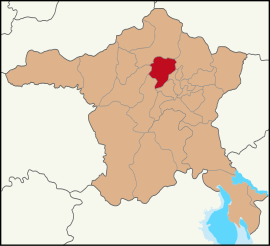
 Map showing Kahramankazan District in Ankara Province | |
| Coordinates: 40°12′23″N 32°40′54″E / 40.20639°N 32.68167°E | |
| Country | Turkey |
| Province | Ankara |
| Government | |
| • Mayor | Selim Çırpanoğlu (CHP) |
Area | 547 km2 (211 sq mi) |
| Elevation | 892 m (2,927 ft) |
| Population (2022)[1] | 59,123 |
| • Density | 110/km2 (280/sq mi) |
| Time zone | UTC+3 (TRT) |
| Postal code | 06980 |
| Area code | 0312 |
| Website | www |
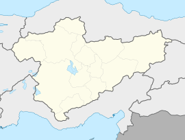
Kahramankazan (before 2016: Kazan) is a municipality and district of Ankara Province, Turkey.[2] Its area is 547 km2,[3] and its population is 59,123 (2022).[1] It lies in the plain of Akıncı to the north west of the city of Ankara. Its elevation is 892 m (2,927 ft).[4]
History
[edit]Archaeological research reveals the plain has a long past, going back to prehistoric times, and findings during the excavation of the Bitik Höyük mound date back to the copper age.[5]
Kahramankazan today
[edit]Today the area is a popular weekend retreat for the people of Ankara. Kahramankazan is a busy small town. Industry in the city includes a brewery and a cement factory.
Opened in November 2011, the Turkish Satellite Assembly, Integration and Test Center (UMET), is situated in the Fethiye neighborhood of the city.
A large trona ore deposit, which lays 600 m (2,000 ft) underground, is mined and processed by Kazan Soda Elektrik of Ciner Holding in the city.[6]
The town was renamed Kahramankazan (Hero Kazan) in 2016 due to the role of local residents in opposing the 2016 Turkish coup d'état attempt.[7]
2024 terrorist attack
[edit]On October 23, 2024, an explosion happened at the headquarters of the Turkish Aerospace Industries, which was located in Kahramankazan. Many were killed and wounded, and some are known as martyrs. The explosion was known as a terrorist attack.[8]
Composition
[edit]There are 48 neighbourhoods in Kahramankazan District:[9]
- Ahi
- Akçaören
- Akıncı
- Alpagut
- Aşağıkaraören
- Atatürk
- Aydın
- Bitik
- Çalta
- Ciğir
- Çimşit
- Dağyaka
- Dutözü
- Emirgazi
- Fatih
- Fethiye
- Günbaşı
- Güvenç
- İçören
- İmrendi
- İnceğiz
- İne
- İymir
- Kanuni Sultan Süleyman
- Karalar
- Kayı
- Kılıçlar
- Kınık
- Kışla
- Kumpınar
- Örencik
- Orhaniye
- Peçenek
- Sancar
- Saraç
- Saray
- Sarıayak
- Sarılar
- Satıkadın
- Soğucak
- Tekke
- Uçarı
- Yakupderviş
- Yassıören
- Yavuz Sultan Selim
- Yayalar
- Yazıbeyli
- Yıldırımbeyazıt
References
[edit]- ^ a b "Address-based population registration system (ADNKS) results dated 31 December 2022, Favorite Reports" (XLS). TÜİK. Retrieved 22 May 2023.
- ^ Büyükşehir İlçe Belediyesi, Turkey Civil Administration Departments Inventory. Retrieved 8 June 2023.
- ^ "İl ve İlçe Yüz ölçümleri". General Directorate of Mapping. Retrieved 22 May 2023.
- ^ Falling Rain Genomics, Inc. "Geographical information on Kazan, Turkey". Retrieved 21 June 2023.
- ^ "Bitik Höyük". Archived from the original on 2016-03-04.
- ^ "Kazan Soda Elektrik" (in Turkish). Ciner Grup. Retrieved 2018-01-17.
- ^ "Kazan ilçesinin adı 'Kahramankazan' oldu". www.aa.com.tr. Retrieved 2023-06-20.
- ^ "Headquarters of state-owned Turkish Aerospace Industries hit by deadly "terrorist attack," official says - CBS News". www.cbsnews.com. 2024-10-23. Retrieved 2024-10-23.
- ^ Mahalle, Turkey Civil Administration Departments Inventory. Retrieved 22 May 2023.
External links
[edit]![]() Media related to Kahramankazan at Wikimedia Commons
Media related to Kahramankazan at Wikimedia Commons
- Official website (in Turkish)
- District municipality's official website (in Turkish)
- A scientific paper on the etymology of the name Kazan


