Panda (town): Difference between revisions
Appearance
Content deleted Content added
m TheBritinator moved page Panda town to Panda (town): Correct disambiguation Tags: Mobile edit Mobile web edit Advanced mobile edit |
-wrong cat./overcategorization |
||
| Line 66: | Line 66: | ||
{{reflist}} |
{{reflist}} |
||
[[Category:Gombe State]] |
|||
[[Category:Akkol District]] |
|||
[[Category:Climate of Nigeria]] |
|||
[[Category:Nigeria geography stubs]] |
[[Category:Nigeria geography stubs]] |
||
[[Category:Populated places in Gombe State]] |
[[Category:Populated places in Gombe State]] |
||
{{GombeNG-geo-stub}} |
{{GombeNG-geo-stub}} |
||
Latest revision as of 12:32, 1 November 2024
Panda | |
|---|---|
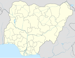
| Coordinates: 9°59′08″N 11°26′45″E / 9.98556°N 11.44583°E | |
| Country | |
| State | Gombe State |
| Headquarters | Akko |
| Government | |
| • Type | Democratic |
| Area | |
• Total | 466 km2 (180 sq mi) |
| Population (2006 census) | |
| • Ethnicities | Fulani Tangale |
| • Religions | mostly populated are Muslims and some few Christians |
| Time zone | UTC1 (WAT) |
Panda is a settlement in the Akko Local Government Area, Gombe State, Nigeria. Panda and Gombe are almost 45 kilometers (28 miles) apart. Panda is 446 km (277 mi) away from Abuja, the Nigerian capital.[1] The postcode of the area is 771102.[2]
Climate
[edit]In Panda, the dry season is partly cloudy, the wet season is oppressive and overcast, and the weather is hot all year round. The average annual temperature fluctuates between 27°F and 34°F.[3]
References
[edit]- ^ "Panda, Nigeria - Facts and information on Panda - Nigeria.Places-in-the-world.com". nigeria.places-in-the-world.com. Retrieved 2024-08-30.
- ^ "Panda, Akko - Postcode - 771102 - Nigeria Postcode". www.nigeriapostcode.com. Retrieved 2024-08-30.
- ^ "Weather Forecast Panda - Nigeria (Gombe) : free 15 day weather forecasts". Weather Crave. 2024-08-31. Retrieved 2024-08-30.

