Miahuatlán, Veracruz: Difference between revisions
Moscow Mule (talk | contribs) m m |
m Fix CW Error #61 with GenFixes (T1) |
||
| Line 114: | Line 114: | ||
==Geography== |
==Geography== |
||
It is located in montane central zone of the State of [[Veracruz (state)|Veracruz]], about 28 km from state capital [[Xalapa]]. It has a surface of 20.56 km2. |
It is located in montane central zone of the State of [[Veracruz (state)|Veracruz]], about 28 km from state capital [[Xalapa]]. It has a surface of 20.56 km2. |
||
Miahuatlán Municipality is delimited to the north by [[Landero y Coss]], to the east by [[Acatlán Municipality, Veracruz|Acatlán Municipality]], to the south by [[Naolinco Municipality]] and to the west by [[Tonayán Municipality]].<ref name="e-local">{{cite web|url=http://www.e-local.gob.mx/work/templates/enciclo/veracruz/municipios/30106a.htm|archive-url=https://archive.today/20070626042748/http://www.e-local.gob.mx/work/templates/enciclo/veracruz/municipios/30106a.htm|url-status=dead|archive-date=2007-06-26|title=Enciclopedia de los Municipios de México: Miahuatlán|publisher=Gobierno Estatal|language=es|access-date=2009-06-11}}</ref> |
Miahuatlán Municipality is delimited to the north by [[Landero y Coss]], to the east by [[Acatlán Municipality, Veracruz|Acatlán Municipality]], to the south by [[Naolinco Municipality]] and to the west by [[Tonayán Municipality]].<ref name="e-local">{{cite web|url=http://www.e-local.gob.mx/work/templates/enciclo/veracruz/municipios/30106a.htm|archive-url=https://archive.today/20070626042748/http://www.e-local.gob.mx/work/templates/enciclo/veracruz/municipios/30106a.htm|url-status=dead|archive-date=2007-06-26|title=Enciclopedia de los Municipios de México: Miahuatlán|publisher=Gobierno Estatal|language=es|access-date=2009-06-11}}</ref> |
||
| Line 131: | Line 131: | ||
}} |
}} |
||
As 2020, the municipality had a population of 4,841 inhabitants in 13 localities.<ref name=2020CENSUSMIAHUATLAN>[http://ceieg.veracruz.gob.mx/wp-content/uploads/sites/21/2022/09/Miahuatl%C3%A1n.CM_.Ver_.2022.4.pdf 2020 Miahuatlán CENSUS]</ref> Miahuatlán, the municipal seat, it's the only considered urban, where 75 |
As 2020, the municipality had a population of 4,841 inhabitants in 13 localities.<ref name=2020CENSUSMIAHUATLAN>[http://ceieg.veracruz.gob.mx/wp-content/uploads/sites/21/2022/09/Miahuatl%C3%A1n.CM_.Ver_.2022.4.pdf 2020 Miahuatlán CENSUS]</ref> Miahuatlán, the municipal seat, it's the only considered urban, where 75% of the population resides (3,667 hab.).<ref name=2020CENSUSMIAHUATLAN/> Other localities include Dos Jacalaes (370 hab.), Cumbre de Jonotal (285 hab.), Yerbabuena (135 hab.) and Carolino Anaya (105 hab.).<ref name=2020CENSUSMIAHUATLAN/> |
||
==Products== |
==Products== |
||
It produces principally [[maize]], [[rice]] and [[coffee]]. |
It produces principally [[maize]], [[rice]] and [[coffee]]. |
||
==Events== |
==Events== |
||
In ''' Miahuatlán ''', in march takes place the celebration in honor to San José, Patron of the town. |
In ''' Miahuatlán ''', in march takes place the celebration in honor to San José, Patron of the town. |
||
==References== |
==References== |
||
Latest revision as of 13:31, 10 December 2024
Miahuatlán | |
|---|---|
 San José Church | |
| Coordinates: 19°42′00″N 96°52′00″W / 19.70000°N 96.86667°W | |
| Country | |
| State | Veracruz |
| Region | Capital Region |
| Municipal seat and largest town | Miahuatlán |
| Government | |
| • Mayor | Héctor Óscar Suárez Sánchez (FM) |
| Area | |
• Total | 29.4 km2 (11.4 sq mi) |
| Elevation (of seat) | 1,970 m (6,460 ft) |
| Population (2020) | |
• Total | 4,841 |
| • Density | 164.8/km2 (427/sq mi) |
| • Seat | 3,667 |
| Time zone | UTC-6 (Central (US Central)) |
| Postal code (of seat) | 91410 |
| Website | (in Spanish) |
Miahuatlán is a municipality in the Mexican state of Veracruz.
Geography
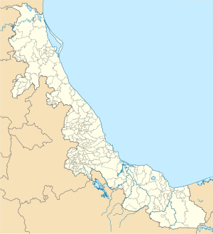
[edit]It is located in montane central zone of the State of Veracruz, about 28 km from state capital Xalapa. It has a surface of 20.56 km2.
Miahuatlán Municipality is delimited to the north by Landero y Coss, to the east by Acatlán Municipality, to the south by Naolinco Municipality and to the west by Tonayán Municipality.[1]
The weather in Miahuatlán is cold all year with rains in summer and autumn.
Demographics
[edit]| Year | Pop. | ±% |
|---|---|---|
| 1995 | 3,598 | — |
| 2000 | 3,807 | +5.8% |
| 2005 | 4,083 | +7.2% |
| 2010 | 4,429 | +8.5% |
| 2015 | 4,685 | +5.8% |
| 2020 | 4,841 | +3.3% |
| [2] | ||
As 2020, the municipality had a population of 4,841 inhabitants in 13 localities.[2] Miahuatlán, the municipal seat, it's the only considered urban, where 75% of the population resides (3,667 hab.).[2] Other localities include Dos Jacalaes (370 hab.), Cumbre de Jonotal (285 hab.), Yerbabuena (135 hab.) and Carolino Anaya (105 hab.).[2]
Products
[edit]It produces principally maize, rice and coffee.
Events
[edit]In Miahuatlán , in march takes place the celebration in honor to San José, Patron of the town.
References
[edit]- ^ "Enciclopedia de los Municipios de México: Miahuatlán" (in Spanish). Gobierno Estatal. Archived from the original on 26 June 2007. Retrieved 11 June 2009.
- ^ a b c d 2020 Miahuatlán CENSUS
External links
[edit]- (in Spanish) Municipal Official webpage
- (in Spanish) Municipal Official Information


