Hai Bà Trưng district: Difference between revisions
mNo edit summary |
No edit summary Tags: Mobile edit Mobile web edit |
||
| Line 1: | Line 1: | ||
{{redirect|Trưng sisters district|the |
{{redirect|Trưng sisters district|the namesake|Trưng sisters}} |
||
{{Infobox settlement |
{{Infobox settlement |
||
| name = Hai Bà Trưng district |
| name = Hai Bà Trưng district |
||
Latest revision as of 03:23, 2 January 2025
Hai Bà Trưng district
Quận Hai Bà Trưng | |
|---|---|
 | |
| Country | |
| Province | Hanoi |
| Seat | Bách Khoa ward |
| Wards | 18 wards[1] |
| Area | |
• Total | 10.26 km2 (3.96 sq mi) |
| Population (2019)[3] | |
• Total | 303,586 |
| • Density | 30,000/km2 (77,000/sq mi) |
| Time zone | UTC+7 (ICT) |
| Area code | 24 |
| Climate | Cwa |
| Website | Official website (in Vietnamese) |
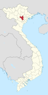
Hai Bà Trưng (Trưng Sisters District) is one of the four original urban districts (quận) of Hanoi, the capital city of Vietnam.[4] The district currently has 18 wards,[1] covering a total area of 10.26 square kilometres (3.96 sq mi).[2] It is bordered by Long Biên district, Đống Đa district, Thanh Xuân district, Hoàng Mai district, Hoàn Kiếm district. As of 2019,[3] there were 303,586 people residing in the district, the population density is 30,000 inhabitants per square kilometer.
Established as one of the first four central districts of the city, it is named after the two heroines in Vietnamese history: the Trưng Sisters. Some of Vietnam's largest universities are located here, including the Hanoi University of Technology, Hanoi National Economic University, and Hanoi University of Civil Engineering.
Administrative divisions
[edit]Hai Bà Trưng district is divided into 18 wards[1] (Bách Khoa, Bạch Đằng, Bạch Mai, Cầu Dền, Đống Mác, Đồng Nhân, Đồng Tâm, Lê Đại Hành, Minh Khai, Nguyễn Du, Phạm Đình Hổ, Phố Huế, Quỳnh Lôi, Quỳnh Mai, Thanh Lương, Thanh Nhàn, Trương Định, Vĩnh Tuy).
References
[edit]- ^ a b c "NGHỊ QUYẾT 895/NQ-UBTVQH14 năm 2020 VỀ VIỆC SẮP XẾP CÁC ĐƠN VỊ HÀNH CHÍNH CẤP XÃ THUỘC THÀNH PHỐ HÀ NỘI". 2020-02-11.
- ^ a b "Niên giám thống kê năm 2018". Retrieved 2021-02-21.
- ^ a b General Statistics Office of Vietnam (2019). "Completed Results of the 2019 Viet Nam Population and Housing Census" (PDF). Statistical Publishing House (Vietnam). ISBN 978-604-75-1532-5.
- ^ "Hà Nội có thêm năm quận mới vào năm 2025". VnExpress. 2019-10-30.
21°00′42″N 105°50′52″E / 21.01167°N 105.84778°E


