Gmina Opatówek: Difference between revisions
Appearance
Content deleted Content added
No edit summary |
No edit summary |
||
| Line 64: | Line 64: | ||
|unit_pref = <!--Enter: Imperial, if Imperial (metric) is desired--> |
|unit_pref = <!--Enter: Imperial, if Imperial (metric) is desired--> |
||
|area_footnotes = |
|area_footnotes = |
||
|area_total_km2 = |
|area_total_km2 = 104,2 |
||
|area_land_km2 = <!--See table @ Template:Infobox Settlement for details on automatic unit conversion--> |
|area_land_km2 = <!--See table @ Template:Infobox Settlement for details on automatic unit conversion--> |
||
|area_water_km2 = |
|area_water_km2 = |
||
| Line 71: | Line 71: | ||
|area_water_sq_mi = |
|area_water_sq_mi = |
||
|area_water_percent = |
|area_water_percent = |
||
|area_urban_km2 = |
|area_urban_km2 = 104,2 |
||
|area_urban_sq_mi = |
|area_urban_sq_mi = |
||
|area_metro_km2 = |
|area_metro_km2 = |
||
| Line 78: | Line 78: | ||
|population_footnotes = |
|population_footnotes = |
||
|population_note = |
|population_note = |
||
|population_total = |
|population_total = 10.000 |
||
|population_density_km2 = |
|population_density_km2 = |
||
|population_density_sq_mi = |
|population_density_sq_mi = |
||
| Line 84: | Line 84: | ||
|population_density_metro_km2 = |
|population_density_metro_km2 = |
||
|population_density_metro_sq_mi = |
|population_density_metro_sq_mi = |
||
|population_urban = |
|population_urban = 10.000 |
||
|population_density_urban_km2 = |
|population_density_urban_km2 = |
||
|population_density_urban_sq_mi = |
|population_density_urban_sq_mi = |
||
Revision as of 15:25, 9 September 2007
Gmina Opatówek | |
|---|---|
Village | |
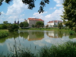
 Opatówek from the pond | |
|
Coat of arms of Gmina Opatówek Coat of arms | |
| Country | Poland |
| Voivodeship | Greater Poland |
| Powiat | Kalisz County |
| Gmina | Opatówek |
| Established | before 1246 |
| City rights | before 1331-1870 |
| Government | |
| • Mayor | Wojciech Jaskóła |
| Area | |
• Village | 1,042 km2 (402 sq mi) |
| • Urban | 1,042 km2 (402 sq mi) |
| Population (2006) | |
• Village | 10.000 |
| • Urban | 10.000 |
| Time zone | UTC+1 (CET) |
| • Summer (DST) | UTC+2 (CEST) |
| Postal code | 62-860 |
| Area code | +48 62 |
| Car Plates | PKA |
| Website | www.opatowek.pl |
Gmina Opatówek, the district (gmina, commune) of Opatówek (German: Spatenfelde), population 10,000, lies east of the city Kalisz, in Kalisz County, Greater Poland Voivodeship, in west-central Poland. The largest village is Opatówek, with 3,800 inhabitants. The gmina includes 27 villages.
Villages
Borów near Kalisz, Chełmce, Cienia-Folwark, Cienia Pierwsza, Cienia Druga, Cienia Trzecia, Dębe-Kolonia, Janików, Józefów, Kobierno, Michałów Drugi, Michałów Trzeci, Nędzerzew, Nowa Tłokinia, Opatówek, Porwity, Rajsko, Rożdżały, Sierzchów, Szałe, Szulec, Tłokinia Kościelna, Tłokinia Mała, Tłokinia Wielka, Trojanów near Kalisz, Warszew, Zawady near Kalisz, Zduny.

