Luzerne County, Pennsylvania: Difference between revisions
Updated Voter Registration Stats |
No edit summary |
||
| Line 7: | Line 7: | ||
founded = September 25, 1786| |
founded = September 25, 1786| |
||
seat = [[Wilkes-Barre, Pennsylvania|Wilkes-Barre]] | |
seat = [[Wilkes-Barre, Pennsylvania|Wilkes-Barre]] | |
||
largest city = Wilkes-Barre | |
|||
area_total_sq_mi =907 | |
area_total_sq_mi =907 | |
||
area_land_sq_mi =891 | |
area_land_sq_mi =891 | |
||
Revision as of 21:10, 16 December 2007
Luzerne County | |
|---|---|
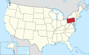
 Location within the U.S. state of Pennsylvania | |
 Pennsylvania's location within the U.S. | |
| Coordinates: 41°11′N 75°59′W / 41.18°N 75.99°W | |
| Country | |
| State | |
| Founded | September 25, 1786 |
| Seat | Wilkes-Barre |
| Largest city | Wilkes-Barre |
| Area | |
• Total | 907 sq mi (2,350 km2) |
| • Land | 891 sq mi (2,310 km2) |
| • Water | 16 sq mi (40 km2) 1.80% |
| Population (2000) | |
• Total | 319,250 |
| • Density | 360/sq mi (138/km2) |
| Website | www |
Luzerne County is a county located in the U.S. state of Pennsylvania. It is located in the northern Anthracite area called "The Coal Region". As of the 2000 census, the population was 319,250. Its county seat is Wilkes-Barre6.
History
Luzerne County was formed in 1786 from part of Northumberland County. Luzerne is infamous for being the last county whose sheriff legally formed a posse to restore order in a time of civil unrest. In 1897, Sheriff James Martin's posse fired on a group of unarmed miners in what is known as the Lattimer Massacre.
The Luzerne County Historical Society maintains the storehouse for the collective memory of Luzerne County and its environs. It records and interprets the history, traditions, events, people and cultures that have directed and molded life within the region.[1]
Geography
According to the U.S. Census Bureau, the county has a total area of 2,349 km² (907 sq mi). 2,307 km² (891 sq mi) of it is land and 42 km² (16 sq mi) of it (1.80%) is water.
Adjacent counties
- Wyoming County (north)
- Lackawanna County (northeast)
- Monroe County (east)
- Carbon County (southeast)
- Schuylkill County (south)
- Columbia County (west)
- Sullivan County (northwest)
Demographics

As of the census² of 2000, there were 319,250 people, 130,687 households, and 84,293 families residing in the county. The population density was 138/km² (358/sq mi). There were 144,686 housing units at an average density of 63/km² (162/sq mi). The racial makeup of the county was 96.63% White, 1.69% Black or African American, 0.09% Native American, 0.58% Asian, 0.01% Pacific Islander, 0.43% from other races, and 0.57% from two or more races. 1.16% of the population were Hispanic or Latino of any race. 22.2% were of Polish, 15.6% Italian, 13.8% Irish, 12.1% German and 5.3% Slovak ancestry according to Census 2000.
There were 130,687 households out of which 26.50% had children under the age of 18 living with them, 48.80% were married couples living together, 11.50% had a female householder with no husband present, and 35.50% were non-families. 31.30% of all households were made up of individuals and 16.00% had someone living alone who was 65 years of age or older. The average household size was 2.34 and the average family size was 2.95.
In the county, the population was spread out with 21.00% under the age of 18, 8.10% from 18 to 24, 27.20% from 25 to 44, 24.00% from 45 to 64, and 19.70% who were 65 years of age or older. The median age was 41 years. For every 100 females there were 93.00 males. For every 100 females age 18 and over, there were 89.50 males.
Luzerne Country is the only county in the United States with a plurality of citizens reporting Polish as their primary ancestry; the majority of Pennsylvanians report German or Pennsylvania Dutch.
Politics

As of November 2007, there are 173,368 registered voters in Luzerne County [2].
- Democratic: 99,122 (57.17%)
- Republican: 60,512 (34.90%)
- Other Parties: 13,734 (7.92%)
Luzerne County is represented by three County Commissioners.[3]
- Gregory A. Skrepenak, Democrat
- Rose Tucker, Democrat (Interim, filling the end of Vonderheid's term)
- Stephen A. Urban, Republican
United States House of Representatives
- Chris Carney, Democrat, Pennsylvania's 10th congressional district
- Paul Kanjorski, Democrat, Pennsylvania's 11th congressional district
- Raphael Musto, Democrat, Pennsylvania's 14th Senatorial District
- Lisa Baker, Republican, Pennsylvania's 10th Senatorial District
- Robert Mellow, Democrat, Pennsylvania's 24th Senatorial District
Pennsylvania House of Representatives
- Jim Wansacz, Democrat, Pennsylvania's 114th Representative District
- Todd Eachus, Democrat, Pennsylvania's 116th Representative District
- Karen Boback, Republican, Pennsylvania's 117st Representative District
- Mike Carroll, Democrat, Pennsylvania's 118th Representative District
- John Yudichak, Democrat, Pennsylvania's 119th Representative District
- Phyllis Mundy, Democrat, Pennsylvania's 120th Representative District
- Eddie Day Pashinski, Democrat, Pennsylvania's 121st Representative District
Municipalities

Under Pennsylvania law, there are four types of incorporated municipalities: cities, boroughs, townships, and, in at most two cases, towns. The following cities, boroughs and townships are located in Luzerne County:
Cities
Boroughs
Townships
Census-designated Places
Census-designated places are geographical areas designated by the U.S. Census Bureau for the purposes of compiling demographic data. They are not actual jurisdictions under Pennsylvania law.
|

Recreation
There are four Pennsylvania state parks in Luzerne County.
Education
Public School Districts
- Berwick Area School District (also in Columbia County)
- Crestwood School District
- Dallas School District
- Greater Nanticoke Area School District
- Hanover Area School District
- Hazleton Area School District (also in Carbon and Schuylkill Counties)
- Lake-Lehman School District (also in Wyoming County)
- Northwest Area School District
- Pittston Area School District
- West Side Area Vocational Technical School WSAVTS
- Wilkes-Barre Area School District
- Wyoming Area School District (also in Wyoming County)
- Wyoming Valley West School District


