Jaun: Difference between revisions
Appearance
Content deleted Content added
m robot Adding: als:Jaun |
タチコマ robot (talk | contribs) m robot Modifying: sv:Jaun |
||
| Line 51: | Line 51: | ||
[[pt:Jaun]] |
[[pt:Jaun]] |
||
[[rm:Jaun]] |
[[rm:Jaun]] |
||
[[sv:Jaun |
[[sv:Jaun]] |
||
[[vo:Jaun]] |
[[vo:Jaun]] |
||
Revision as of 10:57, 1 August 2008
Jaun | |
|---|---|
| Country | Switzerland |
| Canton | Fribourg |
| District | Gruyère |
| Area | |
• Total | 55.24 km2 (21.33 sq mi) |
| Elevation | 1,015 m (3,330 ft) |
| Population (31 December 2018)[2] | |
• Total | 644 |
| • Density | 12/km2 (30/sq mi) |
| Time zone | UTC+01:00 (Central European Time) |
| • Summer (DST) | UTC+02:00 (Central European Summer Time) |
| Postal code(s) | 1656 |
| SFOS number | 2138 |
| ISO 3166 code | CH-FR |
| Surrounded by | Charmey, Plaffeien, Saanen (BE), Boltigen (BE) |
| Website | www SFSO statistics |
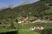
Jaun is a municipality in the district of Gruyère in the canton of Fribourg in Switzerland.
Bellegarde, Im Fang, Kapellboden, Weibelsried and Zur Eich are in the communal territory.
The Jaun Pass connects it with Boltigen in the canton of Bern.

External links
Wikimedia Commons has media related to Jaun.
- Jaun in German, French and Italian in the online Historical Dictionary of Switzerland.
- ^ a b "Arealstatistik Standard - Gemeinden nach 4 Hauptbereichen". Federal Statistical Office. Retrieved 13 January 2019.
- ^ "Ständige Wohnbevölkerung nach Staatsangehörigkeitskategorie Geschlecht und Gemeinde; Provisorische Jahresergebnisse; 2018". Federal Statistical Office. 9 April 2019. Retrieved 11 April 2019.


