Thunder Bay District: Difference between revisions
m →Census subdivisions: + 1 IR |
No edit summary |
||
| Line 17: | Line 17: | ||
|city_logo = |
|city_logo = |
||
|citylogo_size = |
|citylogo_size = |
||
|image_map = |
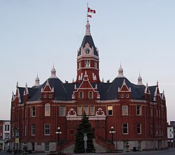
|image_map = Stratford City Hall.jpg |
||
|mapsize = |
|mapsize = |
||
|map_caption = Location of Thunder Bay District in Ontario |
|map_caption = Location of Thunder Bay District in Ontario |
||
Revision as of 20:57, 22 November 2008
Thunder Bay District | |
|---|---|
 Location of Thunder Bay District in Ontario | |
| Country | Canada |
| Province | Ontario |
| Region | Northwestern Ontario |
| Created | 1871 |
| Government | |
| • MPs | Carol Hughes (NDP) Bruce Hyer (NDP) John Rafferty (NDP) |
| • MPPs | Michael Gravelle (OLP) Bill Mauro (OLP) Michael A. Brown (OLP) |
| Area | |
• Total | 103,706.27 km2 (40,041.21 sq mi) |
| Elevation | 220 m (720 ft) |
| Population (2006)[2] | |
• Total | 149,063 |
| • Density | 1.4/km2 (4/sq mi) |
| Canada 2006 Census | |
| Time zone | EST (UTC -5) CST (UTC -6) |
| • Summer (DST) | EDT (UTC -4) CDT (UTC -5) |
| Postal code span | |
| Area code | 807 |
| Largest communities [3] | Thunder Bay (109,140) Oliver Paipoonge (5,757) Greenstone (4,906) |
Thunder Bay District is a district and census division in Northwestern Ontario in the Canadian province of Ontario. The district seat is Thunder Bay.
In 2006, the population was 149,063. The land area is 103,706 km² (40,041 mi²); the population density was 1.4 people/km² (3.7 people/mi²)[1].
History
Thunder Bay District was created in 1871 by provincial statute from the western half of Algoma District. Its northern and western boundaries were uncertain until Ontario's right to Northwestern Ontario was determined by the Judicial Committee of the Privy Council. Until about 1902 it was often called Algoma West from the name of the provincial constituency.
The following districts include areas that were formerly part of Thunder Bay District:
- Rainy River, created in 1885
- Kenora, created in 1907 from Rainy River District
- Cochrane, created in 1921
Population
- Canada 2006 Census: 149,063
Almost 80 per cent of the district's population lives in the Thunder Bay Census Metropolitan Area; no other community in the district exceeds 7,000 in population.
Census subdivisions
Municipalities:
- City of Thunder Bay
- Municipality (town) of Greenstone
- Town of Marathon
- Township of Conmee
- Township of Dorion
- Township of Gillies
- Township of Manitouwadge
- Municipality (township) of Neebing
- Township of Nipigon
- Township of O'Connor
- Municipality (township) of Oliver Paipoonge
- Township of Red Rock
- Township of Schreiber
- Township of Shuniah
- Township of Terrace Bay
First Nations and their Indian Reserves
- Aroland First Nation—Aroland Settlement (Aroland 83)
- Biinjitiwabik Zaaging Anishnabek First Nation (Rocky Bay)—Rocky Bay 1
- Bingwi Neyaashi Anishinaabek First Nation (Sand Point)
- Fort William First Nation—Fort William 52
- Ginoogaming First Nation—Ginoogaming (Long Lac 77)
- Kiashke Zaaging Anishinaabek First Nation (Gull Bay)—Gull River 55
- Lac Des Mille Lacs First Nation—Lac Des Mille Lacs 22A1, Seine River 22A2
- Long Lake 58 First Nation—Long Lake 58
- Namaygoosisagagun First Nation non-Status
- Ojibway Nation of Saugeen First Nation (Savant Lake)—Ojibway Nation of Saugeen
- Ojibways of the Pic River First Nation—Pic River 50
- Pays Plat First Nation—Pays Plat 51
- Pic Mobert First Nation—Pic Mobert North, Pic Mobert South
- Red Rock First Nation (Lake Helen)—Lake Helen 53A, Red Rock 53
- Seine River First Nation—Seine River 23A, Seine River 23B
- Whitesand First Nation—Armstrong Settlement, Whitesand
Unorganized areas
Geographic Neighbors
- Keweenaw County, Michigan - (water boundary)
- Cook County, Minnesota
- Rainy River District, Ontario
- Kenora District, Ontario
- Cochrane District, Ontario
- Algoma District, Ontario
See also
References
- ^ Highest point is 640m, located in Pukaskwa National Park. Thunder Bay is at 183m. 220 is an estimate
- ^ Statcan 2006 Census Profile - Thunder Bay District
- ^ Compilation of Northwestern Ontario's 2006 census data
