Bundesstraße 455: Difference between revisions
translation from German Wikipedia |
|||
| Line 47: | Line 47: | ||
==Route== |
==Route== |
||
Bundesstraße 455 begins in [[Schotten]] in [[Vogelsbergkreis]]. The road continues through the Wetteraukreis, |
Bundesstraße 455 begins in [[Schotten]] in [[Vogelsbergkreis]]. The road continues through the [[Wetteraukreis]], including the municipalities of [[Nidda, Hesse|Nidda]], [[Wölfersheim]], [[Friedberg, Hesse|Friedberg]] and [[Rosbach vor der Höhe]]. Route 455 merges with [[Bundesautobahn 5]] (A-5) at the Friedberg exit and follows this autobahn to the Bad Homburg interchange. It then follows [[Bundesautobahn 661]] (A-661) to its source in [[Oberursel]]-Nord. |
||
| ⚫ | |||
Bundesstraße 455 originally went through [[ |
Bundesstraße 455 originally went through [[Bad Homburg vor der Höhe]] and [[Friedrichsdorf]]. These parts of the route were replaced by the A-5 and A-661 sections, and the original highway has now been downgraded to a state highway (''landesstraße''). Nevertheless, the signs on B-455 from Königstein as well as from Friedberg continue to refer to Bad Homburg. |
||
From Oberursel-Nord, Bundesstraße 455 then takes the so-called "Northern Bypass" (''Nordumgehung'') around Oberursel. Before this tunnel was built, the route originally went through Oberursel. After its constuction, the former route was downgraded to a state highway (L-3004) and a district highway (''kreisstraße'', K-772). |
|||
| ⚫ | |||
=== Municipalities === |
=== Municipalities === |
||
| Line 61: | Line 64: | ||
*** [[Friedrichsdorf]], [[Oberursel (Taunus)]], [[Königstein im Taunus]] |
*** [[Friedrichsdorf]], [[Oberursel (Taunus)]], [[Königstein im Taunus]] |
||
** [[Main-Taunus-Kreis]] |
** [[Main-Taunus-Kreis]] |
||
*** [[Kelkheim (Taunus)]], [[Eppstein]] |
*** [[Kelkheim (Taunus)]], [[Eppstein]] |
||
** Stadt [[Wiesbaden]] |
** Stadt [[Wiesbaden]] |
||
==Source== |
==Source== |
||
Revision as of 16:20, 4 January 2009
| Length: | 100 km | |
| States of Germany: | Hesse | |
| Direction: | Southwest | |

| ||
| Schotten | ||
| Nidda-Harb | ||
| Wölfersheim-Berstadt | ||
| (37) | Wölfersheim | |
| Friedberg | ||
| (16) | Friedberg replaced with A 5 | |
| (17) | Bad Homburger Kreuz replaced with A 661 | |
| (1) | Oberursel-Nord | |
| Tunnel Northern Bypass | ||
| Kronberg | ||
| Königstein | ||
| Eppstein | ||
| (46) | Wiesbaden/Niedernhausen | |
| Wiesbaden 2. Ring | ||
| Wiesbaden-Erbenheim | ||
| (6) | Kreuz Wiesbaden-Erbenheim | |
| Wiesbaden-Erbenheim South | ||
| (3) | Kreuz Mainz-Kastel | |
| Mainz-Kastel | ||
|}
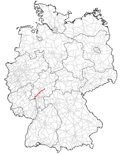
Bundesstraße 455 (abbreviated B-455) is a German Bundesstraße (German for "federal highway") in the federal state of Hesse. The route runs southwest from Schotten in Vogelsbergkreis to Mainz-Kastel, a borough of the Hessian capital city of Wiesbaden.
Route
Bundesstraße 455 begins in Schotten in Vogelsbergkreis. The road continues through the Wetteraukreis, including the municipalities of Nidda, Wölfersheim, Friedberg and Rosbach vor der Höhe. Route 455 merges with Bundesautobahn 5 (A-5) at the Friedberg exit and follows this autobahn to the Bad Homburg interchange. It then follows Bundesautobahn 661 (A-661) to its source in Oberursel-Nord.
Bundesstraße 455 originally went through Bad Homburg vor der Höhe and Friedrichsdorf. These parts of the route were replaced by the A-5 and A-661 sections, and the original highway has now been downgraded to a state highway (landesstraße). Nevertheless, the signs on B-455 from Königstein as well as from Friedberg continue to refer to Bad Homburg.
From Oberursel-Nord, Bundesstraße 455 then takes the so-called "Northern Bypass" (Nordumgehung) around Oberursel. Before this tunnel was built, the route originally went through Oberursel. After its constuction, the former route was downgraded to a state highway (L-3004) and a district highway (kreisstraße, K-772).
Bundesstraße 455 then continues through Königstein im Taunus and Eppstein. It crosses the A-3 and enters Wiesbaden's northeast suburbs. Bundesstraße 455 ends at the Rhine River at the Theodor Heuss Bridge in Mainz-Kastel, a borough of Wiesbaden.
Municipalities
Source
This article incorporates text translated from the corresponding German Wikipedia article as of 2009-01-04.

