Arnott, Wisconsin: Difference between revisions
BlindEagle (talk | contribs) {{Wisconsin-geo-stub}} |
|||
| Line 12: | Line 12: | ||
{{Portage County, Wisconsin}} |
{{Portage County, Wisconsin}} |
||
{{coord|44|27|26|N|89|26|48|W|type:city_region:US-WI|display=title}} |
{{coord|44|27|26|N|89|26|48|W|type:city_region:US-WI|display=title}} |
||
{{Wisconsin-geo-stub}} |
|||
[[Category:Unincorporated communities in Wisconsin]] |
[[Category:Unincorporated communities in Wisconsin]] |
||
Revision as of 18:47, 6 August 2009
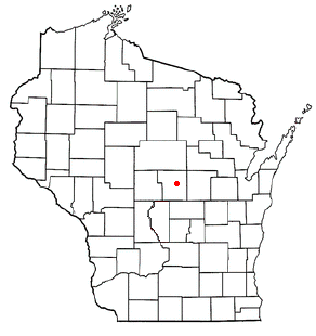
Arnott is an unincorporated community in Portage County, Wisconsin, United States.
Geography

Arnott is located in central Wisconsin approximately four miles east of Plover, approximately four miles south-south west of Custer, and approximately seven miles west of Amherst (Lat: 44° 27' 26.0", Lon: -89° 26' 48.5"). Arnott is located in the town of Stockton.
Economy
Arnott is home to two bars, a feed mill, and an egg roll factory. Arnott also is a stop-over for the "Tomorrow River Rails to Trails," which is an old railroad grade turned into walking path (in the summer), and snowmobile trail (in the winter).
Arnott is less than two miles from the Wimme Sand & Gravel Pit, Milestone Materials' gravel pit, American Asphalt's Custer Road plant, and a traffic safety / road marking company.

