User:Mdzafri: Difference between revisions
Appearance
Content deleted Content added
No edit summary |
No edit summary |
||
| Line 68: | Line 68: | ||
* [[:Template:Location map Malaysia]] |
* [[:Template:Location map Malaysia]] |
||
* [[:Template:Convert]] |
* [[:Template:Convert]] |
||
==Gallery== |
|||
{{Gallery |
|||
|title=Completed works |
|||
|lines=4 |
|||
|Image:Extreme points of Malaysia en.svg|[[Extreme points of Malaysia]]. |
|||
|Image:Malaysia states named.png| |
|||
|Image:Malaysia location map.svg| |
|||
|Image:Kuala Lumpur locator map.svg| |
|||
|Image:Kuala Lumpur constituencies map.svg| |
|||
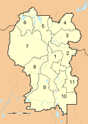
|Image:Selangor districts numbered.svg| |
|||
}} |
|||
Revision as of 10:45, 8 August 2009
Affiliations
Template:User energy portal blaze
|
| Sub-pages |
|---|
| Sandbox |
To do list
- Use this bot for articles.
Extreme points of Malaysia for Outline of Malaysia based on Aussie, Nihon and India extremes.Do this or this to this.Kuala Lumpur state map similar to India's states.New version of File:Malaysia states named.png- State maps with divisions according to administrative districts. Remember to use Template:Subdivisions of Malaysia. Also use Template:Infobox settlement on all suitable locations.
Kuala LumpurAmpang•Bangsar•Brickfields•Kampung Haji Abdullah Hukum•Mont Kiara•Bukit Kiara• Pantai Dalam • Setapak • Sri Petaling • Sungai Besi • Bukit Damansara • Taman OUG •Taman Tun Dr Ismail- Selangor
- Putrajaya
- Negeri Sembilan
- Perak
- Malacca
- Johor
- Kedah
- Kelantan
- Pahang
- Perlis
- Penang
- Sabah
- Sarawak
- Terengganu
- Labuan
- Category:Wikipedia requested maps in Malaysia
- Template:London as a reference to replace Template:Kuala Lumpur
- Template:LB Camden, Template:LB Enfield or any other borough as a reference for KL's divisions/constituencies
How to make SVG country maps
- Get map images for references. The more images the better(er). My main references are:
- Google Maps for Equirectangular maps.
- NASA World Wind using only the country boundary layer.
- The images are brought into Inkscape, and that's where the fun starts. Images from World Wind have to be arranged accordingly on top of equirectangular maps.
- World Wind images are then converted into vector with the Trace Bitmap function using procedures shown here.
- Herein starts the painstaking work of combining the Bézier lines to shape your map.
- Colour the map using colours suggested by Wikipedia:WikiProject Maps
Topo maps tutorials
Please cite GRASS when using the software in your work. Here are some choices depending on the version used:
- GRASS Development Team, 2009. Geographic Resources Analysis Support System (GRASS) Software, Version 6.4.0. http://grass.osgeo.org
Sources
References
- Use Template:Infobox settlement on all locations in Template:Kuala Lumpur
- Use Template:Location map for new location maps of states in Malaysia.
- Wikipedia:WikiProject Malaysia/Collaboration
- Wikipedia:WikiProject Malaysia/Cartography
- Andhra Pradesh for mapping inspiration.
- Template:Infobox Indian Jurisdiction
- Template:Location map Malaysia
- Template:Convert
Gallery
Completed works


