Castro Valley, California: Difference between revisions
Worrydream (talk | contribs) m →Arts and culture: remove comma |
|||
| Line 153: | Line 153: | ||
==External links== |
==External links== |
||
*[http://www.castrovalleychamber.com/ Castro Valley Chamber of Commerce] |
|||
*[http://www.mycastrovalley.com/history/ Castro Valley history] |
*[http://www.mycastrovalley.com/history/ Castro Valley history] |
||
* |
*[http://www.cv.k12.ca.us/ Castro Valley Unified School District] |
||
*[http://www.friendsofsanlorenzocreek.org/ Friends of San Lorenzo Creek] |
*[http://www.friendsofsanlorenzocreek.org/ Friends of San Lorenzo Creek] |
||
Revision as of 17:39, 29 March 2010
37°41′39″N 122°05′11″W / 37.69417°N 122.08639°W
Castro Valley, California | |
|---|---|
 Castro Valley Boulevard | |
 Location of Castro Valley within Alameda County, California. | |
| Country | United States |
| State | California |
| County | Alameda |
| Government | |
| • Mayor | N/A (Alameda County Board of Supervisors) |
| • Senate | Loni Hancock (D) Ellen Corbett (D) |
| • Assembly | Mary Hayashi (D) Alberto Torrico (D) |
| • U. S. Congress | Barbara Lee (D) (CA-09) |
| Area | |
• Total | 14.8 sq mi (38.2 km2) |
| • Land | 14.4 sq mi (37.4 km2) |
| • Water | 0.3 sq mi (0.8 km2) |
| Elevation | 164 ft (50 m) |
| Population (2000 Census) | |
• Total | 57,262 |
| • Density | 3,869/sq mi (1,494/km2) |
| Time zone | UTC-8 (PST) |
| • Summer (DST) | UTC-7 (PDT) |
| ZIP codes | 94546, 94552 |
| Area code | 510 |
| FIPS code | 06-11964 |
| GNIS feature ID | 1658237 |
Castro Valley is a census-designated place (CDP) in Alameda County, California, United States. As of the 2000 census, it is the fifth most populous unincorporated area in California, and the twenty-third in the United States.
History
Before the arrival of European settlers the area was settled by the Chocheño (also spelled Chochenyo or Chocenyo) subdivision of the Ohlone Native Americans.
With the arrival of Europeans, Castro Valley was part of the land granted to Mission San Jose in 1797. The area Castro Valley now occupies was part of the extensive colony of New Spain in what was the state of Alta California.
Castro Valley is named after Don Guillermo Castro, who was a soldier in the Mexican army and a rancher. Castro Valley was part of the original 28,000 acre (110 km²) land grant given to Castro, called Rancho San Lorenzo. This land grant included Hayward, San Lorenzo, and Castro Valley, including Crow Canyon, Cull Canyon, and Palomares Canyons. Castro had a gambling habit and had to sell off portions of his land to pay gambling debts. The last of his holding was sold in a sheriff's sale in 1864 to Faxon Atherton for $400,000.[1]
Atherton (after whom the city of Atherton is named[1]) in turn began selling off his portion in smaller parcels. Two gentlemen named Cull (the namesake of Cull Canyon) and Luce bought some 2,400 acres (10 km²) and began running a steam-operated saw mill in Redwood Canyon. The Jensen brothers also bought land from Atherton in 1867.
During the 1940s and 1950s, Castro Valley was known for its chicken ranches. Later it developed into a bedroom community, where workers live and commute to their jobs in the surrounding communities.[2]
Geography
Castro Valley is located at 37°42′14″N 122°4′46″W / 37.70389°N 122.07944°W (37.703796, -122.079384).Template:GR Lake Chabot lies at the north of Castro Valley. Directly to the west is San Leandro. Hayward is to the south. To the east, the closest cities are San Ramon, Dublin and Pleasanton. The San Leandro Hills extend along the northeastern edge of the community.
The eastern hills of Castro Valley constitute the headwaters of the San Lorenzo Creek watershed and the origin of several creeks that flow into San Lorenzo Creek: Bolinas, Castro Valley, Chabot, Crow, Cull, Eden, Hollis, Kelly Canyon, Norris, and Palomares creeks.

Demographics
As of the censusTemplate:GR of 2000, there were 57,292 people, 21,606 households, and 15,016 families residing in the CDP. The population density was 3,971.6 people per square mile (1,533.0/km²). There were 22,003 housing units at an average density of 1,525.3/sq mi (588.7/km²). The racial makeup of the CDP was 70.84% White, 5.14% Black or African American, 0.59% Native American, 13.54% Asian, 0.44% Pacific Islander, 4.11% from other races, and 5.34% from two or more races. 12.19% of the population were Hispanic or Latino of any race.
There were 21,606 households out of which 32.3% had children under the age of 18 living with them, 54.0% were married couples living together, 11.0% had a female householder with no husband present, and 30.5% were non-families. 23.2% of all households were made up of individuals and 9.3% had someone living alone who was 65 years of age or older. The average household size was 2.58 and the average family size was 3.05.
In the CDP the population was spread out with 23.7% under the age of 18, 6.8% from 18 to 24, 29.8% from 25 to 44, 25.0% from 45 to 64, and 14.7% who were 65 years of age or older. The median age was 39 years. For every 100 females there were 94.6 males. For every 100 females age 18 and over, there were 91.0 males.
The median income for a household in the CDP was $76,197, and the median income for a family was $91,713 as of a 2008 estimate[3]. About 2.7% of families and 4.5% of the population were below the poverty line, including 4.3% of those under age 18 and 4.5% of those age 65 or over.
Arts and culture
Castro Valley is one of the sites where Joseph Eichler built some of the 10,000 or so homes he built in the Bay Area.[4]
Law and government
Castro Valley is an unincorporated community and thus is governed directly by the County of Alameda. To date, all efforts to incorporate Castro Valley have been voted down by its residents.[2]
Education
Castro Valley is served by the Castro Valley Unified School District. Overall, the district contains almost 9,000 students. The district includes the following public schools:[5]
- High schools:
- Castro Valley High School with 2840 students,[6]
- Redwood High School, an alternative high school with approximately 193 students in 2005.[7]
- Middle schools:
- Elementary schools:
- Castro Valley Elementary
- Chabot
- Independent
- Jensen Ranch
- Marshall
- Palomares
- Proctor
- Stanton
- Vannoy
- Castro Valley Adult School
There is also a Roman Catholic school, called Our Lady of Grace (K-8), which is part of the Roman Catholic Diocese of Oakland. Redwood Christian Schools has two elementary schools in Castro Valley: Crossroads Christian Elementary and Redwood Christian Elementary.[8] Castro Valley also holds a private elementary school and preschool called Camelot Elementary.
Transportation
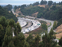
Interstate 580, which approaches from the east, makes a turn northward at Castro Valley. Interstate 238, which originates in Castro Valley, connects I-580 to Interstate 880. In addition to being served by those two freeways, Castro Valley is served with public transportation by bus system AC Transit, and rapid transit system BART with a station.


Notable residents
- Mike Bordin drummer for Faith No More, drummer for Ozzy Osbourne, and several time with of Bay Area Musician award for Best Drummer, was raised in Castro Valley[citation needed]
- Cliff Burton, bassist of Metallica, attended Castro Valley High School[4]
- Mike Carlucci, actor, King of Queens, Sports Announcer most notably Anaheim Ducks, Los Angeles Dodgers, and many Olympics, born in Castro Valley[citation needed]
- Jason Castro (baseball), Baseball player, born in Castro Valley[9]
- Spencer Christian, local weather reporter for ABC News.[citation needed]
- Val Diamond of Beach Blanket Babylon[10]
- Garret Dillahunt, Actor, No Country For Old Men, born in Castro Valley[11]
- Kyle Gass, musician of the band Tenacious D, was born in Castro Valley[citation needed]
- Tony Gemignani, world's most famous pizza tosser, owns a pizza parlor in Castro Valley (Pyzano's Pizza).[12]
- Rachel Maddow, anchor and political analyst on MSNBC's The Rachel Maddow Show and The Rachel Maddow Show on Air America Radio.[13]
- "Big" Jim Martin, former guitar player for Faith No More[14]
- Jack Del Rio, head coach of the NFL team The Jacksonville Jaguars[15]
- Daniel Selby, Actor and singer, was born in Castro Valley[citation needed]
- Duane "Beans" Sousa, Singer Songwriter and former guitarist and studio and touring musician for Lacy J. Dalton, and Leon Russell at Shelter Records , was raised in Castro Valley[citation needed]
- Christopher Titus nationally renowned stand-up comedian and star of TV sitcom Titus[citation needed]
Crimes
On 1 May 2003, the body of a young girl was found in a large green bag near the dumpster of a Carrows restaurant. After years of research, it was revealed that the girl was 16-year-old Yesenia Nungaray.[16]
References
- ^ a b Gudde, Erwin Gustav. "California Place Names: The Origin and Etymology of Current Geographical Names" University of California Press 2004. 495 pp.
- ^ a b Lorge, L, Phelps, R, Weston, D. "Castro Valley" Arcadia Publishing, 2005. 128 pp.
- ^ http://factfinder.census.gov/servlet/ADPTable?_bm=y&-geo_id=16000US0611964&-qr_name=ACS_2008_3YR_G00_DP3YR3&-context=adp&-ds_name=ACS_2008_3YR_G00_&-tree_id=3307&-_lang=en&-redoLog=false&-format=
- ^ a b Jones, Carolyn (June 08, 2000). "Vanishing Eichlers / Devotees try to curb loss of 1950s-era modernist tract homes". San Francisco Chronicle. Hearst Communications Inc. Retrieved 22 February 2010.
{{cite news}}: Check date values in:|date=(help) Cite error: The named reference "sfgate" was defined multiple times with different content (see the help page). - ^ "Our Schools — Castro Valley Unified School District". Retrieved 2008-09-02.
- ^ "2007-2008 School Profile - Castro Valley High School" (pdf). Retrieved 2008-09-02.
- ^ "Redwood Alternative High School/Redwood Continuation High School". Retrieved 2008-09-02.
- ^ "Redwood Christian Schools". Redwood Christian Schools. 2008. Retrieved 2008-11-19.
- ^ http://www.sfgate.com/cgi-bin/article.cgi?f=/c/a/2005/03/30/SPGECC0J8L1.DTL
- ^ Klatte, Arline. "Profile: Val Diamond". E-Guide Entertainment on the Gate. Hearst Communications Inc. Retrieved 2008-08-11.
- ^ http://www.imdb.com/name/nm0226813
- ^ Bauer, Michael (June 25, 2008). "Pizza of the Week: Pyzano's in Castro Valley". San Francisco Chronicle. Hearst Communications, Inc. pp. F-2. Retrieved 2008-11-16.
- ^ Garofoli, Joe (September 5, 2008). "Rachel Maddow Talks to Us on GOP Culture War (Podcast)". SFGATE.com. Hearst Communications, Inc. Retrieved 2008-11-16.
- ^ Chirazi, Steffan (October 5, 1997). "LOSING THE FAITH RENEWS MARTIN'S HOPE". San Francisco Chronicle. Hearst Communications, Inc. pp. PK-55. Retrieved 2008-11-16.
- ^ Miller, Ira (December 29, 2004). "Jaguars are losing the luster". San Francisco Chronicle. Hearst Communications, Inc. pp. D-1. Retrieved 2008-11-16.
- ^ Brown, Robert (10 November 2007). "AMW FUGITIVE DATA FILE FOR Miguel Angel Nunez-Castaneda". Americas Most Wanted. FOX Broadcasting Company. Retrieved 2008-08-11.


