Ixtlahuacán del Río: Difference between revisions
Appearance
Content deleted Content added
Dr. Blofeld (talk | contribs) No edit summary |
m Robot - Moving category Cities, towns and villages in Jalisco to Populated places in Jalisco per CFD at Wikipedia:Categories for discussion/Log/2010 May 28. |
||
| Line 132: | Line 132: | ||
{{Jalisco}} |
{{Jalisco}} |
||
[[Category:Municipalities of Jalisco]] |
[[Category:Municipalities of Jalisco]] |
||
[[Category: |
[[Category:Populated places in Jalisco]] |
||
[[es:Ixtlahuacán del Río]] |
[[es:Ixtlahuacán del Río]] |
||
Revision as of 13:09, 10 June 2010
Ixtlahuacán del Río | |
|---|---|
Municipality and city | |
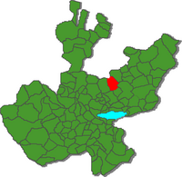
 Location of the municipality in Jalisco | |
| Country | |
| State | Jalisco |
| Area | |
• Total | 594.94 km2 (229.71 sq mi) |
| Population (2005) | |
• Total | 18,157 |
Ixtlahuacán del Rio is a town and municipality in the center of the Mexican state of Jalisco, a little less than 50 kilometers from state capital Guadalajara. It stands at 1,655 meters above sea level; the climate is semi-arid, with a mild winter and an average annual temperature of 19 degrees Celsius (66 degrees Fahrenheit).
Pre-Hispanic antecedents of Ixtlahuacán del Río
Ixtlahuacán is a word of Nahuatl origin; the name means "flat place". It was founded by Toltecs approximately A.D. 610; it is hard to be certain of the exact date of founding, because none of the groups who inhabited the region — Tecuexes, Tepehuanes, Coanes, Cazcanos, and Zacatecos — had a written language in this period.

