Epe, Lagos State: Difference between revisions
Appearance
Content deleted Content added
m Robot - Moving category Cities, towns and villages in Lagos State to Populated places in Lagos State per CFD at Wikipedia:Categories for discussion/Log/2010 May 28. |
m Robot - Moving category Coastal settlements in Nigeria to Populated coastal places in Nigeria per CFD at Wikipedia:Categories for discussion/Log/2010 May 28. |
||
| Line 77: | Line 77: | ||
[[Category:Populated places in Lagos State]] |
[[Category:Populated places in Lagos State]] |
||
[[Category:Local Government Areas in Lagos State]] |
[[Category:Local Government Areas in Lagos State]] |
||
[[Category: |
[[Category:Populated coastal places in Nigeria]] |
||
{{LagosNG-geo-stub}} |
{{LagosNG-geo-stub}} |
||
Revision as of 02:32, 12 June 2010
Epe, Nigeria | |
|---|---|
LGA and town | |
 | |
| Country | |
| State | Lagos State |
| Time zone | UTC+1 (WAT) |
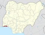
Epe is a town and Local Government Area (LGA) in Lagos State, Nigeria[1] located on the north side of the Lekki Lagoon. As of 2004 the estimated population of Epe was 111,464.[1]
Links
References
- ^ a b "NigeriaCongress.org". Retrieved 2007-04-08.

