Lautertal, Bavaria: Difference between revisions
Appearance
Content deleted Content added
m Add references section and/or general fixes. |
m robot Adding: war:Lautertal, Bavaria |
||
| Line 49: | Line 49: | ||
[[vi:Lautertal, Coburg]] |
[[vi:Lautertal, Coburg]] |
||
[[vo:Lautertal (Bayern)]] |
[[vo:Lautertal (Bayern)]] |
||
[[war:Lautertal, Bavaria]] |
|||
Revision as of 21:29, 13 June 2010
Lautertal | |
|---|---|
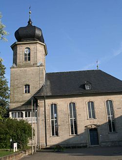
 Protestant church | |
Location of Lautertal within Coburg district | |
| Country | Germany |
| State | Bavaria |
| Admin. region | Oberfranken |
| District | Coburg |
| Government | |
| • Mayor | Klaus Forkel |
| Area | |
• Total | 30.34 km2 (11.71 sq mi) |
| Highest elevation | 527 m (1,729 ft) |
| Lowest elevation | 300 m (1,000 ft) |
| Population (2023-12-31)[1] | |
• Total | 4,553 |
| • Density | 150/km2 (390/sq mi) |
| Time zone | UTC+01:00 (CET) |
| • Summer (DST) | UTC+02:00 (CEST) |
| Postal codes | 96486 |
| Dialling codes | 09561, 09566 |
| Vehicle registration | CO |
| Website | www.gemeindelautertal.de |
Lautertal is a municipality in the district of Coburg in Bavaria in Germany. Near Lautertal, there was between 1952 and 1992 a DECCA-transmitter.
References
- ^ Genesis Online-Datenbank des Bayerischen Landesamtes für Statistik Tabelle 12411-003r Fortschreibung des Bevölkerungsstandes: Gemeinden, Stichtag (Einwohnerzahlen auf Grundlage des Zensus 2011).


