Druhanov: Difference between revisions
Appearance
Content deleted Content added
m Robot - Moving category Cities, towns and villages in Havlíčkův Brod District to Populated places in Havlíčkův Brod District per CFD at Wikipedia:Categories for discussion/Log/2010 May 28. |
m Bot) Add coordinates_region parameter (report errors? |
||
| Line 3: | Line 3: | ||
|settlement_type=Municipality |
|settlement_type=Municipality |
||
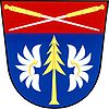
|image_skyline=|image_shield=Druhanov znak.jpg|image_flag=Druhanov vlajka.jpg |
|image_skyline=|image_shield=Druhanov znak.jpg|image_flag=Druhanov vlajka.jpg |
||
|coordinates_region=CZ |
|||
|subdivision_type=Country |
|subdivision_type=Country |
||
| ⚫ | |||
|subdivision_name={{CZE}} |
|||
| ⚫ | |||
| ⚫ | |||
|subdivision_name1=[[Vysočina Region|Vysočina]] |
|||
|subdivision_type2=[[Districts of the Czech Republic|District]] |
|||
| ⚫ | |||
|latd=49|latm=41|lats=53|latNS=N|longd=15|longm=24|longs=38|longEW=E |
|latd=49|latm=41|lats=53|latNS=N|longd=15|longm=24|longs=38|longEW=E |
||
|pushpin_map=Czech Republic|coordinates_display=title |
|pushpin_map=Czech Republic|coordinates_display=title |
||
Revision as of 02:37, 14 June 2010
Druhanov | |
|---|---|
Municipality | |
| Country | |
| Region | Vysočina |
| District | Havlíčkův Brod |
| Area | |
• Total | 3.91 km2 (1.51 sq mi) |
| Elevation | 496 m (1,627 ft) |
| Population (2006) | |
• Total | 156 |
| • Density | 40/km2 (100/sq mi) |
| Postal code | 582 91 |
| Website | http://www.sweb.cz/druhanov/ |
Druhanov is a village and municipality (obec) in Havlíčkův Brod District in the Vysočina Region of the Czech Republic.
The municipality covers an area of 3.91 square kilometres (1.51 sq mi), and has a population of 156 (as at 3 July 2006).
Druhanov lies approximately 16 kilometres (10 mi) north-west of Havlíčkův Brod, 36 km (22 mi) north of Jihlava, and 84 km (52 mi) south-east of Prague.


