Podstenje: Difference between revisions
Appearance
Content deleted Content added
m Robot - Moving category Cities, towns and villages in Slovenia to Populated places in Slovenia per CFD at Wikipedia:Categories for discussion/Log/2010 May 15. |
m Bot) Add coordinates_region and/or _display parameters (report errors? |
||
| Line 31: | Line 31: | ||
|pushpin_label_position =top |
|pushpin_label_position =top |
||
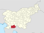
|pushpin_map_caption =Location in Slovenia |
|pushpin_map_caption =Location in Slovenia |
||
|coordinates_display = inline,title |
|||
|coordinates_region = SI |
|||
|subdivision_type = Country |
|subdivision_type = Country |
||
|subdivision_name = [[Image:Flag of Slovenia.svg|25px]] [[Slovenia]] |
|subdivision_name = [[Image:Flag of Slovenia.svg|25px]] [[Slovenia]] |
||
Revision as of 19:31, 18 June 2010
Podstenje | |
|---|---|
| Country | |
| Region | Inner Carniola |
| Municipality | Ilirska Bistrica |
| Area | |
• Total | 1.98 km2 (0.76 sq mi) |
| Elevation | 486.1 m (1,594.8 ft) |
| Population (2002) | |
• Total | 71 |
| [1] | |
Podstenje is a village to the north of Ilirska Bistrica in the Inner Carniola region of Slovenia.[2]
The local church in the settlement is dedicated to Saint Anthony of Padua and belongs to the Ilirska Bistrica Parish.[3]
References
External links

