Kaniakapupu: Difference between revisions
Appearance
Content deleted Content added
No edit summary |
Undid revision 375645550 by 72.130.220.201 (talk) |
||
| Line 1: | Line 1: | ||
{{coord|21|21| |
{{coord|21|21|02.7|N|157|48|52.07|W|region:US_type:landmark|display=title}} |
||
{{Infobox_nrhp | name =Kaniakapupu |
{{Infobox_nrhp | name =Kaniakapupu |
||
| nrhp_type = |
| nrhp_type = |
||
Revision as of 23:17, 29 July 2010
21°21′02.7″N 157°48′52.07″W / 21.350750°N 157.8144639°W
Kaniakapupu | |
 The ruined remains of Kaniakapupu | |
| Nearest city | Nuʻuanu, Hawaii |
|---|---|
| Built | 1845 |
| NRHP reference No. | 86002805 [1] |
| Added to NRHP | October 15, 1986 |
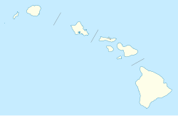
Kaniakapupu ("the singing of the land shells") is the now dilapidated summer palace of king Kamehameha III and his queen Kalama on Oahu in Hawaii. The palace was completed in 1845 and was a place for entertaining foreign celebrities, chiefs, and commoners.
On Hawaiian Restoration Day in 1847, a luau attended by an estimated ten thousand people gathered at the palace.
References
- ^ "National Register Information System". National Register of Historic Places. National Park Service. 2008-04-15.
External links
- Nuʻuanu, Oʻahu, A Native Place: Kaniakapupu

