Nyíregyháza Airport: Difference between revisions
Appearance
Content deleted Content added
DSisyphBot (talk | contribs) m robot Adding: ms:Lapangan Terbang Nyiregyhaza |
m →External links: Adding DEFAULTSORT to page with special characters (WP:CHECKWIKI error 37) + genfixes using AWB (7089) |
||
| Line 44: | Line 44: | ||
* {{ASN|LHNY}} |
* {{ASN|LHNY}} |
||
{{DEFAULTSORT:Nyiregyhaza Airport}} |
|||
[[Category:Airports in Hungary]] |
[[Category:Airports in Hungary]] |
||
[[Category:Szabolcs-Szatmár-Bereg County]] |
[[Category:Szabolcs-Szatmár-Bereg County]] |
||
Revision as of 10:49, 4 September 2010
Nyíregyháza Airport | |||||||||||||||
|---|---|---|---|---|---|---|---|---|---|---|---|---|---|---|---|
| Summary | |||||||||||||||
| Airport type | Public | ||||||||||||||
| Serves | Nyíregyháza, Hungary | ||||||||||||||
| Elevation AMSL | 338 ft / 103 m | ||||||||||||||
| Coordinates | 47°59′02″N 021°41′32″E / 47.98389°N 21.69222°E | ||||||||||||||
| Website | www.trenerkft.hu | ||||||||||||||
 | |||||||||||||||
| Runways | |||||||||||||||
| |||||||||||||||
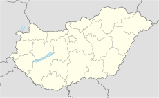
Nyíregyháza Airport (ICAO: LHNY) is an airport serving Nyíregyháza,[1] a city in Szabolcs-Szatmár-Bereg county, Hungary.
Facilities
The airport resides at an elevation of 338 feet (103 m) above mean sea level. It has two runways: 18R/36L has an asphalt pavement measuring 1,000 by 20 metres (3,281 ft × 66 ft) and 18L/36R has a grass surface measuring 1,000 by 60 metres (3,281 ft × 197 ft).[1]
References
- ^ a b c Airport information for LHNY from DAFIF (effective October 2006)
- ^ Airport information for LHNY at Great Circle Mapper. Source: DAFIF (effective October 2006).
External links

