Knocknamuck: Difference between revisions
Appearance
Content deleted Content added
deletion of higher level category. Insert South Tipperary category. |
typo corrections. |
||
| Line 28: | Line 28: | ||
{{coord missing|County Tipperary}} |
{{coord missing|County Tipperary}} |
||
[[Category: |
[[Category:Geography of South Tipperary County]] |
||
{{Tipperary-geo-stub}} |
{{Tipperary-geo-stub}} |
||
Revision as of 18:58, 4 September 2010
| Knocknamuck | |
|---|---|
| Cnoc na Muc | |
 | |
| Highest point | |
| Elevation | 340 m (1,120 ft) |
| Prominence | 268 m (879 ft) |
| Listing | Marilyn |
| Geography | |
| Location | Tipperary, Ireland |
| Parent range | Slieveardagh Hills |
| Topo map | OSi Discovery 67 |
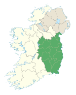
Knocknamuck (Template:Lang-ga) is a mountain in South Tipperary, Ireland. Its name means Hill of the Pig. At 340 metres (1,115 ft) it is highest summit in the Slieveardagh Hills and the 916th highest summit in Ireland.
See also

