Obingwa: Difference between revisions
Appearance
Content deleted Content added
m BOT: Checking dead links; Marked 1 link with {{Dead link}} (Further info: WP:DEADLINK) |
Crusoe8181 (talk | contribs) m correct link |
||
| Line 66: | Line 66: | ||
It has an area of 395 km² and a population of 181,439 at the 2006 census. |
It has an area of 395 km² and a population of 181,439 at the 2006 census. |
||
The [[postal code]] of the area is 453.<ref>{{cite web | title = Post Offices- with map of LGA | work = | publisher = NIPOST | url = http://www.nipost.gov.ng/ |
The [[postal code]] of the area is 453.<ref>{{cite web | title = Post Offices- with map of LGA | work = | publisher = NIPOST | url = http://www.nipost.gov.ng/Postoffice.aspx | accessdate = 2009-10-20 }}</ref> |
||
==References== |
==References== |
||
Revision as of 08:16, 16 October 2010
Obi Ngwa | |
|---|---|
 | |
| Country | |
| State | Abia State |
| Capital | Mgboko |
| Area | |
• Total | 153 sq mi (395 km2) |
| Population (2006) | |
• Total | 181,439 |
| Time zone | UTC+1 (WAT) |
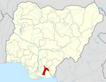
Obi Ngwa is a Local Government Area of Abia State, Nigeria. Its headquarters are in the town of Mgboko.
It has an area of 395 km² and a population of 181,439 at the 2006 census.
The postal code of the area is 453.[1]
References
- ^ "Post Offices- with map of LGA". NIPOST. Retrieved 2009-10-20.

