Epe, Lagos State: Difference between revisions
Appearance
Content deleted Content added
Luckas-bot (talk | contribs) m robot Adding: sv:Epe, Nigeria |
m robot Modifying: pt:Epe (Nigéria) |
||
| Line 81: | Line 81: | ||
[[de:Epe (Nigeria)]] |
[[de:Epe (Nigeria)]] |
||
[[pt:Epe ( |
[[pt:Epe (Nigéria)]] |
||
[[ro:Epe, Nigeria]] |
[[ro:Epe, Nigeria]] |
||
[[sv:Epe, Nigeria]] |
[[sv:Epe, Nigeria]] |
||
Revision as of 10:44, 7 November 2010
Epe, Nigeria | |
|---|---|
LGA and town | |
 | |
| Country | |
| State | Lagos State |
| Area | |
• Total | 458 sq mi (1,185 km2) |
| Population (2006) | |
• Total | 181,409 |
| Time zone | UTC+1 (WAT) |
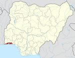
Epe is a town and Local Government Area (LGA) in Lagos State, Nigeria[1] located on the north side of the Lekki Lagoon. At the 2006 Census the population of Epe was 181,409.[1]
Links
References
- ^ a b "NigeriaCongress.org". Retrieved 2007-04-08.

