Spring Valley State Park: Difference between revisions
Appearance
Content deleted Content added
To provide geographical coordinates according to GNIS |
infobox and short history |
||
| Line 1: | Line 1: | ||
{{Infobox Protected area |
|||
| ⚫ | '''Spring Valley State Park''' is a [[Nevada |
||
| name = Spring Valley State Park |
|||
| iucn_category = |
|||
| photo = |
|||
| photo_alt = |
|||
| photo_caption = |
|||
| photo_width = |
|||
| map = Nevada |
|||
| map_alt = |
|||
| map_caption = |
|||
| map_width = 175 |
|||
| location = [[Lincoln County, Nevada|Lincoln County]], [[Nevada]] |
|||
| nearest_city = [[Ursine, Nevada]] |
|||
| lat_d = 38 |
|||
| lat_m = 03 |
|||
| lat_s = 14 |
|||
| lat_NS = N |
|||
| long_d = 114 |
|||
| long_m = 10 |
|||
| long_s = 14 |
|||
| long_EW = W |
|||
| area = {{convert|1281|acres|ha}} |
|||
| established = 1969 |
|||
| visitation_num = |
|||
| visitation_year = |
|||
| governing_body = [[Nevada Division of State Parks]] |
|||
}} |
|||
| ⚫ | '''Spring Valley State Park''' is a [[List of Nevada state parks|Nevada state park]] in [[Lincoln County, Nevada|Lincoln County]], [[Nevada]]. It is located near the eastern border with the state of [[Utah]], {{convert|20|mi}} east of the town of [[Pioche, Nevada|Pioche]] and near the village of [[Ursine, Nevada|Ursine]].<ref name="NVDSP-SVSP">{{cite web|title=Spring Valley State Park|url=http://parks.nv.gov/sv.htm|publisher=Nevada Division of State Parks|accessdate=November 9, 2010}}</ref> |
||
==History== |
|||
The Eagle Valley Dam was built in 1965, creating the 65-acre (26 ha) Eagle Valley Reservoir for agricultural usage. The area around the reservoir was designated a state park in 1969.<ref name="NVDSP-SVSP" /> |
|||
==See also== |
|||
*[[List of Nevada state parks]] |
|||
*[[Eagle Valley (Nevada)]] |
|||
==References== |
|||
{{reflist}} |
|||
==External links== |
==External links== |
||
*[http://parks.nv.gov/sv.htm Spring Valley State Park |
*[http://parks.nv.gov/sv.htm Spring Valley State Park] at the Nevada Division of State Parks (Official site) |
||
{{coord|38|03|14|N|114|10|14|W|display=title}} |
{{coord|38|03|14|N|114|10|14|W|display=title}} |
||
| Line 10: | Line 48: | ||
[[Category:Lincoln County, Nevada]] |
[[Category:Lincoln County, Nevada]] |
||
[[Category:Nevada state parks]] |
[[Category:Nevada state parks]] |
||
{{nevada-geo-stub}} |
{{nevada-geo-stub}} |
||
Revision as of 20:42, 9 November 2010
| Spring Valley State Park | |
|---|---|
| Location | Lincoln County, Nevada |
| Nearest city | Ursine, Nevada |
| Area | 1,281 acres (518 ha) |
| Established | 1969 |
| Governing body | Nevada Division of State Parks |
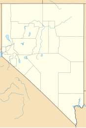
Spring Valley State Park is a Nevada state park in Lincoln County, Nevada. It is located near the eastern border with the state of Utah, 20 miles (32 km) east of the town of Pioche and near the village of Ursine.[1]
History
The Eagle Valley Dam was built in 1965, creating the 65-acre (26 ha) Eagle Valley Reservoir for agricultural usage. The area around the reservoir was designated a state park in 1969.[1]
See also
References
- ^ a b "Spring Valley State Park". Nevada Division of State Parks. Retrieved November 9, 2010.
External links
- Spring Valley State Park at the Nevada Division of State Parks (Official site)

