Man, West Virginia: Difference between revisions
m Remove Mapit-US-cityscale, add coords to title, using AWB |
|||
| Line 82: | Line 82: | ||
==Geography== |
==Geography== |
||
Man is located at {{coord|37|44|34|N|81|52|31|W|city}} (37.742776, -81.875168){{GR|1}}. |
The Man is located at {{coord|37|44|34|N|81|52|31|W|city}} (37.742776, -81.875168){{GR|1}}. |
||
According to the [[United States Census Bureau]], the town has a total area of 1.6 [[km²]] (0.6 [[square mile|mi²]]). 1.5 km² (0.6 mi²) of it is land and 0.1 km² (0.04 mi²) of it (4.92%) is water. |
According to the [[United States Census Bureau]], the town has a total area of 1.6 [[km²]] (0.6 [[square mile|mi²]]). 1.5 km² (0.6 mi²) of it is land and 0.1 km² (0.04 mi²) of it (4.92%) is water. |
||
Revision as of 22:39, 11 November 2010
Man, West Virginia | |
|---|---|
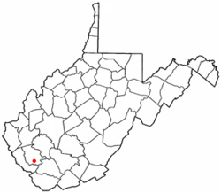
 Location of Man, West Virginia | |
| Country | United States |
| State | West Virginia |
| County | Logan |
| Area | |
• Total | 0.6 sq mi (1.6 km2) |
| • Land | 0.6 sq mi (1.5 km2) |
| • Water | 0.0 sq mi (0.1 km2) |
| Elevation | 738 ft (225 m) |
| Population (2000) | |
• Total | 770 |
| • Density | 1,313.1/sq mi (507.0/km2) |
| Time zone | UTC-5 (Eastern (EST)) |
| • Summer (DST) | UTC-4 (EDT) |
| ZIP code | 25635 |
| Area code | 304 |
| FIPS code | 54-50932Template:GR |
| GNIS feature ID | 1542706Template:GR |
Man is a town in Logan County, West Virginia, United States. The population was 770 at the 2000 census. Man is located along the Guyandotte River at the mouth of Buffalo Creek,[1] which was the site of the 1972 Buffalo Creek Flood following a dam collapse. The name of the town is believed to have come from the last syllable of the name of Ulysses Hinchman, who was a member of the West Virginia House of Delegates from Logan County between 1866 and 1869.[2]
Geography
The Man is located at 37°44′34″N 81°52′31″W / 37.74278°N 81.87528°WInvalid arguments have been passed to the {{#coordinates:}} function (37.742776, -81.875168)Template:GR.
According to the United States Census Bureau, the town has a total area of 1.6 km² (0.6 mi²). 1.5 km² (0.6 mi²) of it is land and 0.1 km² (0.04 mi²) of it (4.92%) is water.
Demographics
As of the censusTemplate:GR of 2000, there were 770 people, 336 households, and 229 families residing in the town. The population density was 503.9/km² (1,313.1/mi²). There were 363 housing units at an average density of 237.6/km² (619.0/mi²). The racial makeup of the town was 94.68% White, 1.95% African American, 3.25% Asian and 0.13% Pacific Islander. Hispanic or Latino of any race were 0.91% of the population.
There were 336 households out of which 24.1% had children under the age of 18 living with them, 51.5% were married couples living together, 12.8% had a female householder with no husband present, and 31.8% were non-families. 27.4% of all households were made up of individuals and 14.6% had someone living alone who was 65 years of age or older. The average household size was 2.29 and the average family size was 2.79.
In the town the population was spread out with 19.4% under the age of 18, 8.1% from 18 to 24, 24.4% from 25 to 44, 29.9% from 45 to 64, and 18.3% who were 65 years of age or older. The median age was 44 years. For every 100 females there were 90.1 males. For every 100 females age 18 and over, there were 85.9 males.
The median income for a household in the town was $40,179, and the median income for a family was $45,893. Males had a median income of $37,212 versus $24,583 for females. The per capita income for the town was $21,304. About 18.9% of families and 21.2% of the population were below the poverty line, including 36.3% of those under age 18 and 10.2% of those age 65 or over.
Education
Man is served by Man High School, the "Home of the Hillbillies," Man Middle, Man, Buffalo, and South Man Elementary.
References
- ^ West Virginia Atlas & Gazetteer. Yarmouth, Me.: DeLorme. 1997. p. 57. ISBN 0-89933-246-3.
- ^ Kenny, Hamill (1945). West Virginia Place Names: Their Origin and Meaning, Including the Nomenclature of the Streams and Mountains. Piedmont, West Virginia: The Place Name Press. p. 400.

