Podstenje: Difference between revisions
Appearance
Content deleted Content added
m →External links: Disperse category and/or GFs using AWB |
m r2.6.4) (robot Adding: hr:Podstenje |
||
| Line 128: | Line 128: | ||
{{IlirskaBistrica-geo-stub}} |
{{IlirskaBistrica-geo-stub}} |
||
[[hr:Podstenje]] |
|||
[[nl:Podstenje]] |
[[nl:Podstenje]] |
||
[[sl:Podstenje]] |
[[sl:Podstenje]] |
||
Revision as of 21:22, 29 January 2011
Podstenje | |
|---|---|
| Country | |
| Region | Inner Carniola |
| Municipality | Ilirska Bistrica |
| Area | |
• Total | 1.98 km2 (0.76 sq mi) |
| Elevation | 486.1 m (1,594.8 ft) |
| Population (2002) | |
• Total | 71 |
| [1] | |
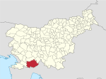
Podstenje is a village to the north of Ilirska Bistrica in the Inner Carniola region of Slovenia.[2]
The local church in the settlement is dedicated to Saint Anthony of Padua and belongs to the Ilirska Bistrica Parish.[3]
References
External links

