Knarvik: Difference between revisions
Crusoe8181 (talk | contribs) mNo edit summary |
Geschichte (talk | contribs) m I often find myself confusing these two |
||
| Line 1: | Line 1: | ||
{{distinguish|Knarrevik}} |
|||
[[Image:KnarvikSeenFromHogstefjellet.jpg|right|thumb|200px|Knarvik]] |
[[Image:KnarvikSeenFromHogstefjellet.jpg|right|thumb|200px|Knarvik]] |
||
[[Image:Knarviksenter.jpg|right|thumb|200px|Knarvik Senter]] |
[[Image:Knarviksenter.jpg|right|thumb|200px|Knarvik Senter]] |
||
Revision as of 12:18, 31 January 2011


Knarvik (or Knarrviki) is the administrative centre in the municipality of Lindås and the largest town in the region of Nordhordland, Norway. It had 4,265 inhabitants as of 2005.[1]
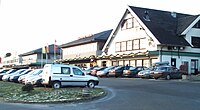
The town is based around Knarvik Senter, the largest shopping centre in the region of Nordhordland with 61 stores. The E39 runs straight through the town dividing the town into two major parts. The northern part consists of a larger shopping area covered with glass ceiling while the southern part is still in its original state with scattered buildings and shops.
Knarvik has several kindergartens, a junior high school and a regional high school (Knarvik vidaregåande skule) with more than 1,000 students.
In recent years population and traffic has increased creating demand for an upgrade of the infrastructure. Rush traffic is an increasingly common sight.
Today Knarvik is connected with Bergen via the Hagelsund Bridge (finished 1982) and the Nordhordland Bridge (finished 1994). The car ferry connection between Knarvik and Bergen (Knarvik - Steinestø), that shipped cars and people up until the completion of the Nordhordland Bridge, was at one time carrying more vehicles than any other car ferry connection in Norway.
