Kajtasovo: Difference between revisions
Appearance
Content deleted Content added
m Replacing Gajtas1.jpg with File:Kajtasovo,_Orthodox_Church.jpg (by ZooFari because: File renamed: more descriptive name). |
m +commonscat |
||
| Line 19: | Line 19: | ||
{{South Banat District}} |
{{South Banat District}} |
||
{{coord|44|53|N|21|15|E|region:RS_type:city|display=title}} |
{{coord|44|53|N|21|15|E|region:RS_type:city|display=title}} |
||
| ⚫ | |||
{{commonscat|Kajtasovo}} |
|||
[[Category:Places in Serbian Banat]] |
[[Category:Places in Serbian Banat]] |
||
[[Category:Populated places in Vojvodina]] |
[[Category:Populated places in Vojvodina]] |
||
[[Category:South Banat District]] |
[[Category:South Banat District]] |
||
| ⚫ | |||
[[eo:Kajtasovo]] |
[[eo:Kajtasovo]] |
||
Revision as of 08:17, 28 February 2011

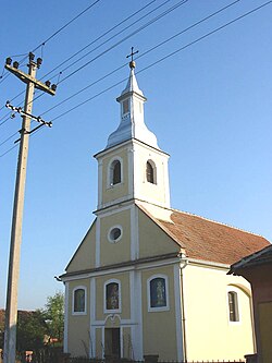
Kajtasovo (Кајтасово) is a village in Serbia. It is situated in the Bela Crkva municipality, in the South Banat District, Vojvodina province. The village has a Serb ethnic majority and its population numbering 287 people (2002 census).
Historical population
- 1961: 494
- 1971: 459
- 1981: 424
- 1991: 350
- 2002: 287
References
- Slobodan Ćurčić, Broj stanovnika Vojvodine, Novi Sad, 1996.
See also
44°53′N 21°15′E / 44.883°N 21.250°E
Wikimedia Commons has media related to Kajtasovo.
