Ontario Highway 47: Difference between revisions
→Route description: fix |
→See also: hopefully this template won't apply any more |
||
| Line 99: | Line 99: | ||
{{York Regional Roads}} |
{{York Regional Roads}} |
||
[[Category:Defunct Ontario provincial highways|047]] |
[[Category:Defunct Ontario provincial highways|047]] |
||
{{Ontario-road-stub}} |
|||
Revision as of 18:31, 5 March 2011
| Route information | ||||
|---|---|---|---|---|
| Maintained by Ministry of Transportation of Ontario | ||||
| Length | 34.3 km[1] (21.3 mi) | |||
| Existed | 1937–1998 | |||
| Major junctions | ||||
| West end | ||||
| East end | ||||
| Location | ||||
| Country | Canada | |||
| Province | Ontario | |||
| Counties | York Durham | |||
| Towns | Stouffville Uxbridge Scugog | |||
| Highway system | ||||
| ||||
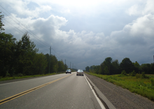
King's Highway 47, also known as Highway 47 and locally as Stouffville Road, Toronto Street and Brock Street was a provincial highway in the Canadian province of Ontario. The mostly rural route travelled through the towns of Whitchurch-Stouffville, Goodwood, and Uxbridge on its east–west path between Highway 48 and Highway 12.
Route description

The highway began at Highway 48, and travelled east through the town of Whitchurch-Stouffville. It then turned north along the Tenth line, following it to Bloomington Road and York - Durham Line. It turned east into the Regional Municipality of Durham and passed through Goodwood. The highway then zig-zagged northeast to the town of Uxbridge. From there, the highway continued east past Durham Regional Road 23 (Lakeridge Road), ending at Highway 12 south of Greenbank.
Major intersections
| Division | Location | km[1] | Destinations | Notes |
|---|---|---|---|---|
| York | Stouffville | 0.0 | Continues west as Stouffville Road | |
| 2.1 | ||||
| 4.2 | ||||
| 8.6 | Bloomington Road travels west while York–Durham Line travels north–south | |||
| Durham | ||||
| Goodwood | 12.2 | |||
| Uxbridge | 17.1 | |||
| 24.5 | Western junction with Durham Regional Road 8 | |||
| 24.7 | Eastern junction with Durham Regional Road 8 | |||
| 27.0 | ||||
| Scugog | 34.3 |

