Ōe, Yamagata: Difference between revisions
Appearance
Content deleted Content added
m Name in full |
m r2.6.4) (robot Adding: uk:Ое (Ямаґата) |
||
| Line 51: | Line 51: | ||
[[ja:大江町]] |
[[ja:大江町]] |
||
[[ru:Оэ (посёлок)]] |
[[ru:Оэ (посёлок)]] |
||
[[uk:Ое (Ямаґата)]] |
|||
[[zh:大江町]] |
[[zh:大江町]] |
||
Revision as of 21:22, 17 March 2011

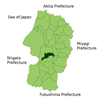
Ōe (大江町, Ōe-machi) is a town located in Nishimurayama District, Yamagata, Japan.
As of 2003, the town has an estimated population of 10,160 and a density of 66.01 persons per km². The total area is 153.92 km².
The name Ōe means "Big River", and is a reference to the Mogami River that forms its eastern border.
Like many small towns in Japan, Ōe is a collection of smaller hamlets. Elevation rises and populations decrease as one moves westward. The easternmost village is called Aterazawa, and contains about 4/5 of the town's population.
By train, Aterazawa Station in Ōe is the last stop on the Aterazawa Line, which connects it to the capital city, Yamagata.
Transportation
Train stations
Major roads
Events
- Oe Doll's Festival(March)
- Mogami River rower's song contest(June)
Landmarks
- Tateyama Park(ruin of The Tateyama castle)
- Yanagawa spa
-
Oe Office
-
Mogami Bridge
-
Aterazawa Haramachi
-
Kokain Temple
-
Yanagawa spa
-
Duck family
External links
- Ōe official website (in Japanese)
38°23′N 140°12′E / 38.383°N 140.200°E


