Florencia, Caquetá: Difference between revisions
No edit summary |
No edit summary |
||
| Line 9: | Line 9: | ||
|image_skyline = Plaza Pizarro.jpg |
|image_skyline = Plaza Pizarro.jpg |
||
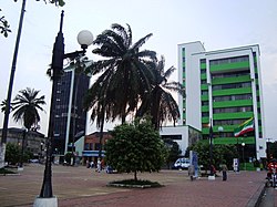
|image_caption = Downtown of Florencia |
|image_caption = Downtown of Florencia |
||
|image_flag = |
|image_flag = Bandera FLA.jpg |
||
|image_seal = |
|image_seal = Escudo Florencia Caquetá.jpg |
||
|image_map = MunsCaqueta Florencia.png |
|image_map = MunsCaqueta Florencia.png |
||
|mapsize = 250px |
|mapsize = 250px |
||
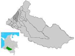
|map_caption = Location of the municipality and town of Florencia |
|map_caption = Location of the municipality and town of Florencia in the Caquetá Department of Colombia. |
||
|pushpin_map = Colombia |
|pushpin_map = Colombia |
||
|pushpin_map_caption = Location in Colombia |
|pushpin_map_caption = Location in Colombia |
||
| Line 27: | Line 27: | ||
|established_date = |
|established_date = |
||
|area_magnitude = |
|area_magnitude = |
||
|area_total_km2 = |
|area_total_km2 = 2292 |
||
|area_land_km2 = |
|area_land_km2 = |
||
|area_water_km2 = |
|area_water_km2 = |
||
|area_water_percent = |
|area_water_percent = |
||
|population_as_of = |
|population_as_of = 2010 |
||
|population_note = |
|population_note = DANE |
||
|population_total = 157,450 |
|population_total = 157,450 |
||
|population_density_km2 = auto |
|population_density_km2 = auto |
||
|latd = 1|latm = 37|lats = |latNS = N |
|latd = 1|latm = 37|lats =03 |latNS = N |
||
|longd = 75|longm = 36|longs = |longEW = W |
|longd = 75|longm = 36|longs =03 |longEW = W |
||
|coordinates_type = region:CO_type:city |
|coordinates_type = region:CO_type:city |
||
|coordinates_display = title |
|coordinates_display = title |
||
| Line 42: | Line 42: | ||
|utc_offset = -05 |
|utc_offset = -05 |
||
|elevation_m = |
|elevation_m = |
||
|website = |
|website = www.florencia-caqueta.gov.co |
||
|footnotes = |
|footnotes = |
||
}} |
}} |
||
Revision as of 21:04, 5 May 2011
You can help expand this article with text translated from the corresponding article in Spanish. (January 2011) Click [show] for important translation instructions.
|
Florencia | |
|---|---|
Municipality and town | |
 Downtown of Florencia | |
 Location of the municipality and town of Florencia in the Caquetá Department of Colombia. | |
| Country | |
| Region | Amazonas Region |
| Department | Caquetá Department |
| Area | |
• Total | 2,292 km2 (885 sq mi) |
| Population (2010) | |
• Total | 157,450 |
| • Density | 69/km2 (180/sq mi) |
| DANE | |
| Time zone | UTC-05 (Colombia Standard Time) |
| Website | www.florencia-caqueta.gov.co |
Florencia (Template:Lang-en) is a municipality and capital city of the Department of Caquetá, Colombia. It is the most important city in southeast Colombia because of its population as well as its more than a hundred years of history. It is the boundary between mountains and the Amazon. It lies on the Orteguaza River which flows into the Caqueta River. Its population is roughly 160,000.
History
Florencia was founded on December 25, 1902 by Capuchin Friar Doroteo De Pupiales (1876-1959) Born in Pupiales, Nariño, Colombia.
Geography
Florencia is located by the steps of the Cordillera Oriental mountain range. The municipality of Florencia limits to the north with the Huila Department and the municipality of El Paujil, to the east with the municipalities of El Paujil and La Montañita, to the south with the municipalities of Milán and Morelia, and to the west with the municipality of Belén de Andaquies and the Huila Department.
