Embu Airport: Difference between revisions
| Line 50: | Line 50: | ||
Embu Airport is a small civilian airport, serving the town of [[Embu]] and surrounding communities. Situated at {{convert|1265|m|ft}} above sea level, the [[airport]] has a single [[Asphalt|asphalt]] [[runway]] which measures {{convert|2953|ft|m}} in length.<ref>[http://www.gcmap.com/airport/HKEM Altitude And Length of Nanyuki Airport Runway]</ref> |
Embu Airport is a small civilian airport, serving the town of [[Embu]] and surrounding communities. Situated at {{convert|1265|m|ft}} above sea level, the [[airport]] has a single [[Asphalt|asphalt]] [[runway]] which measures {{convert|2953|ft|m}} in length.<ref>[http://www.gcmap.com/airport/HKEM Altitude And Length of Nanyuki Airport Runway]</ref> |
||
==Scheduled airlines and destinations== |
==Scheduled airlines and destinations== |
||
{{underconstruction}} |
|||
==External links== |
==External links== |
||
Revision as of 23:06, 28 July 2011
This article is actively undergoing a major edit for a little while. To help avoid edit conflicts, please do not edit this page while this message is displayed. This page was last edited at 23:06, 28 July 2011 (UTC) (13 years ago) – this estimate is cached, . Please remove this template if this page hasn't been edited for a significant time. If you are the editor who added this template, please be sure to remove it or replace it with {{Under construction}} between editing sessions. |
Embu Airport | |||||||||||
|---|---|---|---|---|---|---|---|---|---|---|---|
| Summary | |||||||||||
| Airport type | Public, Civilian | ||||||||||
| Owner | Kenya Airports Authority | ||||||||||
| Operator | Kenya Airports Authority | ||||||||||
| Serves | Embu | ||||||||||
| Location | Embu, | ||||||||||
| Elevation AMSL | 4,150 ft / 1,265 m | ||||||||||
| Coordinates | 00°34′08″S 37°29′32″E / 0.56889°S 37.49222°E | ||||||||||
 | |||||||||||
| Runways | |||||||||||
| |||||||||||
Embu Airport is an airport Kenya.
Location
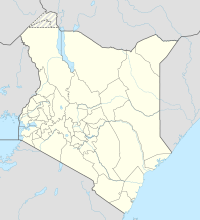
Embu Airport, (IATA: n/a, ICAO: HKEM), is located in Embu County, Embu District, Eastern Province, in the town of Embu.
Located about 6 kilometres (3.7 mi), by road, southeast of Embu's central business district, the airport lies to the immediate northeast of Donbosco Boys' Secondary School, on Embu-Kintiri Road.
This location lies approximately 108 kilometres (67 mi), by air, northeast of Nairobi International Airport, the country’s largest civilian airport.[1] The geographic coordinates of this airport are:0° 34' 8.00"S, 37° 29' 32.00"E (Latitude:0.568890; Longitude:37.492221).
Overview
Embu Airport is a small civilian airport, serving the town of Embu and surrounding communities. Situated at 1,265 metres (4,150 ft) above sea level, the airport has a single asphalt runway which measures 2,953 feet (900 m) in length.[2]
Scheduled airlines and destinations
This article or section is in a state of significant expansion or restructuring. You are welcome to assist in its construction by editing it as well. If this article or section has not been edited in several days, please remove this template. If you are the editor who added this template and you are actively editing, please be sure to replace this template with {{in use}} during the active editing session. Click on the link for template parameters to use.
This article was last edited by Fsmatovu (talk | contribs) 13 years ago. (Update timer) |
External links
- Location of Embu Airport At Google Maps
- Website of Kenya Airports Authority
- List of Airports In Kenya
- Airkenya Routes
See also
- Embu
- Embu District
- Eastern Province (Kenya)
- Kenya Airports Authority
- Kenya Civil Aviation Authority
- List of airports in Kenya

