Ososo: Difference between revisions
| Line 140: | Line 140: | ||
===History=== |
===History=== |
||
According to [[oral tradition]], the people of Ososo migrated from “Ogbe” in present day [[Benin City]] in the 17th century during the era of fierce and violent inter-tribal wars between [[Benin kingdom]] and its neighbours and due to general disenchantment with the harsh economic realities of their day. The early settlers were attracted to Ososo because of its rocks, caves, temperate climate, springs and fertile lands. The expansion of descendant family lineage brought about the present four clans that the town is now made up of. Although there are many common family names in Ososo, a few include Orifa, Okogbe, Itomo, Ogedengbe, Ogidan, Osheku, Obaitan, Bodunde, Arokamoni (or Arokhamoni) and Agbaje etc. |
According to [[oral tradition]], the people of Ososo migrated from “Ogbe” in present day [[Benin City]] in the 17th century during the era of fierce and violent inter-tribal wars between [[Benin kingdom]] and its neighbours and due to general disenchantment with the harsh economic realities of their day. The early settlers were attracted to Ososo because of its rocks, caves, temperate climate, springs and fertile lands. The expansion of descendant family lineage brought about the present four clans that the town is now made up of. Although there are many common family names in Ososo, a few include Otaru, Orifa, Okogbe, Itomo, Ogedengbe, Ogidan, Osheku, Obaitan, Bodunde, Arokamoni (or Arokhamoni) and Agbaje etc. |
||
====Tourism==== |
====Tourism==== |
||
Revision as of 09:34, 23 September 2011
Ososo | |
|---|---|
| Country | |
| State | Edo State |
| Elevation | 1,236 ft (377 m) |
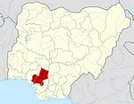
Ososo is a scenic town of streams and rocks in the undulating Somorika hills. The town is located in Akoko-Edo Local Government Area, in the north of Edo State, Nigeria. With an average altitude of 1236 feet above sea level, it enjoys a very temperate climate similar to that of Jos, Plateau State. The highest peak is a very large monolith of called the Oruku rock.
Description
The town is made up of four clans: Anni, Egbetua, Okhe and Ikpena. With an approximated population of 40,000 and a combined population density of 5,111 per 7 km radius, it is one of the largest towns in the Local Government Area. Ososo has a unique dialect of the Ghotuo-Uneme-Yekhee branch of the Edoid linguistic lineage. [1]
Ososo shares boundaries with Okene to the north, Okpella to the East, Makeke to the west, Ojah to the South and Ogori to the north-west. It is a boundary town between Edo and Kogi States.
History
According to oral tradition, the people of Ososo migrated from “Ogbe” in present day Benin City in the 17th century during the era of fierce and violent inter-tribal wars between Benin kingdom and its neighbours and due to general disenchantment with the harsh economic realities of their day. The early settlers were attracted to Ososo because of its rocks, caves, temperate climate, springs and fertile lands. The expansion of descendant family lineage brought about the present four clans that the town is now made up of. Although there are many common family names in Ososo, a few include Otaru, Orifa, Okogbe, Itomo, Ogedengbe, Ogidan, Osheku, Obaitan, Bodunde, Arokamoni (or Arokhamoni) and Agbaje etc.
Tourism
Ososo town is of granitic nature, with some elevations of volcanic origin containing precious stones of varied descriptions. Located on a plateau of dispersed rocks and undulating hills, the town continues to be a haven for tourists. Because of its rocks and climate, some Europeans established a quarry company north of the town, known as BOK Quarry some years ago.
The rocks and hills of varied sizes and shapes occupy the plateau with the natural magical posture of a thousand models posing to nature’s camera.
The colonial administrations as early as the 19th century recognized the tourist potential, and the military administrator Mohammed Abul-Salam Onuka (1993-1994) made some attempt to develop the tourist potential, but since then the area has been neglected. However, the tourism potentials of Ososo received a boost recently as Nigerian Breweries PLC (makers of Gulder larger beer), relaunch their 2011 Gulder Ultimate Search Season 8, in Egbetua, Ososo.
[2]
From the tourist centre, a rest house renovated by the Edo state government, there is a beautiful sight of rocks expanding all the way to Kogi state.[3]
References
- ^ "Linguistic Lineage for Ososo". Ethnologue. Retrieved 2009-12-28.
- ^ Paul Ogbuokiri (22 December 2009). "Anniversary - Youths Hail Oshiomhole". Daily Champion. Retrieved 2009-12-28.
- ^ "70 Exciting Tourist Spots". OnlineNigeria. Retrieved 2009-12-28.

