Slovene Riviera: Difference between revisions
Appearance
Content deleted Content added
m m |
m fix |
||
| Line 1: | Line 1: | ||
{{underconstruction}} |
{{underconstruction}} |
||
'''Slovenian Riviera''' ({{lang-sl|'''''Slovenska obala'''''}}) is the coastal area of the Republic of [[Slovenia]] on the [[Adriatic Sea]]. It is part of the [[Istria]]n peninsula and is |
'''Slovenian Riviera''' ({{lang-sl|'''''Slovenska obala'''''}}) is the coastal area of the Republic of [[Slovenia]] on the [[Adriatic Sea]]. It is part of the [[Istria]]n peninsula and is 46,6 km<ref>[https://www.cia.gov/library/publications/the-world-factbook/geos/si.html The World Factbook by CIA]</ref> long. |
||
==Geography== |
==Geography== |
||
Revision as of 00:21, 7 November 2011
This article or section is in a state of significant expansion or restructuring. You are welcome to assist in its construction by editing it as well. If this article or section has not been edited in several days, please remove this template. If you are the editor who added this template and you are actively editing, please be sure to replace this template with {{in use}} during the active editing session. Click on the link for template parameters to use.
This article was last edited by DerBorg (talk | contribs) 13 years ago. (Update timer) |
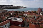
Slovenian Riviera (Template:Lang-sl) is the coastal area of the Republic of Slovenia on the Adriatic Sea. It is part of the Istrian peninsula and is 46,6 km[1] long.
Geography
Located in Slovenian Istria, the Riviera belongs to the statistical region Obalno-kraška and to the historical region of Primorska. It is bordered in north by Italy and in south by Croatia. The northernmost point is the headland of Debeli Rtič, by the Gulf of Koper; and the southernmost one is the village of Sečovlje, by the Gulf of Piran.
The territory includes the towns of Koper, Izola and Piran, and 9 villages belonging to this municipalities:
- Koper: Ankaran and Bertoki.
- Izola: Dobrava and Jagodje.
- Piran: Lucija, Parecag, Portorož, Seča and Sečovlje.
Photogallery
-
Koper
-
Izola
-
Piran
-
Portorož
References
External links
 Media related to Slovenian Riviera at Wikimedia Commons


