Rennesøy: Difference between revisions
No edit summary |
m clean up using AWB |
||
| Line 12: | Line 12: | ||
| demonym = Rennesøybu |
| demonym = Rennesøybu |
||
| language = [[Nynorsk]] |
| language = [[Nynorsk]] |
||
| coatofarms = |
| coatofarms = Rennesøy komm.svg |
||
| munwebpage = www.rennesoy.kommune.no |
| munwebpage = www.rennesoy.kommune.no |
||
| mayor = Jostein Eiane |
| mayor = Jostein Eiane |
||
| Line 18: | Line 18: | ||
| mayor_as_of = 2003 |
| mayor_as_of = 2003 |
||
| area_rank = 413 |
| area_rank = 413 |
||
| area_total_km2 |
| area_total_km2 = 65 |
||
| area_land_km2 |
| area_land_km2 = 65 |
||
| area_water_percent |
| area_water_percent = 0.02 |
||
| population_as_of = 2009 |
| population_as_of = 2009 |
||
| population_rank = 256 |
| population_rank = 256 |
||
| population_total = 3921 |
| population_total = 3921 |
||
| populationpercent = 0.07 |
| populationpercent = 0.07 |
||
| population_density_km2= 51 |
| population_density_km2 = 51 |
||
| population_increase= 26.0 |
| population_increase = 26.0 |
||
| latd = 59 | latm = 6 | lats = 4 | longd = 5 | longm = 43 | longs = 55 |
| latd = 59 | latm = 6 | lats = 4 | longd = 5 | longm = 43 | longs = 55 |
||
| utm_zone = 32V | utm_northing = 6555899 | utm_easting = 0312855 | geo_cat = adm2nd |
| utm_zone = 32V | utm_northing = 6555899 | utm_easting = 0312855 | geo_cat = adm2nd |
||
| Line 32: | Line 32: | ||
{{Historical populations |
{{Historical populations |
||
|footnote = '''''Source''': [http://www.ssb.no/english/subjects/02/02/folkendrhist_en/tables/tab/1142.html Statistics Norway]<ref>[http://statbank.ssb.no/statistikkbanken/Default_FR.asp?PXSid=0&nvl=true&PLanguage=0&tilside=selecttable/hovedtabellHjem.asp&KortnavnWeb=folkfram Projected population - Statistics Norway]</ref><ref>Per 1 January 1965, 1142 Rennesøy and 1143 Mosterøy were merged to one municipality, 1142 Rennesøy.</ref> |
|footnote = '''''Source''': [http://www.ssb.no/english/subjects/02/02/folkendrhist_en/tables/tab/1142.html Statistics Norway].<ref>[http://statbank.ssb.no/statistikkbanken/Default_FR.asp?PXSid=0&nvl=true&PLanguage=0&tilside=selecttable/hovedtabellHjem.asp&KortnavnWeb=folkfram Projected population - Statistics Norway]</ref><ref>Per 1 January 1965, 1142 Rennesøy and 1143 Mosterøy were merged to one municipality, 1142 Rennesøy.</ref> |
||
|shading = off |
|shading = off |
||
|1951|1483 |
|1951|1483 |
||
| Line 54: | Line 54: | ||
===Coat-of-arms=== |
===Coat-of-arms=== |
||
The [[Coat of arms|coat-of-arms]] is from modern times. They were granted on 20 February 1981. The arms show two [[crosier]]s. In the present municipality one of Norway's oldest and best preserved [[Monastery|monasteries]], [[Utstein Abbey|Utstein]], is situated. Hence the choice for the crosier.<ref>{{cite web|url=http://www.ngw.nl/int/nor/r/rennesoy.htm|author=Norske Kommunevåpen| |
The [[Coat of arms|coat-of-arms]] is from modern times. They were granted on 20 February 1981. The arms show two [[crosier]]s. In the present municipality one of Norway's oldest and best preserved [[Monastery|monasteries]], [[Utstein Abbey|Utstein]], is situated. Hence the choice for the crosier.<ref>{{cite web|url=http://www.ngw.nl/int/nor/r/rennesoy.htm|author=Norske Kommunevåpen|year=1990|title=Nye kommunevåbener i Norden|accessdate=12 October 2008}}</ref> |
||
==References== |
==References== |
||
Revision as of 00:29, 2 December 2011
Rennesøy Municipality
Rennesøy kommune | |
|---|---|
 | |
|
| |
 Rogaland within Norway | |
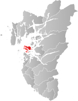
 Rennesøy within Rogaland | |
| Country | Norway |
| County | Rogaland |
| District | Ryfylke |
| Administrative centre | Vikevåg |
| Government | |
| • Mayor (2003) | Jostein Eiane (KrF) |
| Area | |
• Total | 65 km2 (25 sq mi) |
| • Land | 65 km2 (25 sq mi) |
| • Rank | #413 in Norway |
| Population (2009) | |
• Total | 3,921 |
| • Rank | #256 in Norway |
| • Density | 51/km2 (130/sq mi) |
| • Change (10 years) | |
| Demonym | Rennesøybu[1] |
| Official language | |
| • Norwegian form | Nynorsk |
| Time zone | UTC+01:00 (CET) |
| • Summer (DST) | UTC+02:00 (CEST) |
| ISO 3166 code | NO-1142[3] |
| Website | Official website |
| Year | Pop. | ±% |
|---|---|---|
| 1951 | 1,483 | — |
| 1961 | 1,418 | −4.4% |
| 1971 | 2,045 | +44.2% |
| 1981 | 2,363 | +15.6% |
| 1991 | 2,578 | +9.1% |
| 2001 | 3,168 | +22.9% |
| 2011 | 4,202 | +32.6% |
| 2021? | 5,961 | +41.9% |
| 2031? | 7,639 | +28.1% |
| Source: Statistics Norway.[4][5] | ||
Rennesøy is a municipality in Rogaland county, Norway. It is part of the region of Ryfylke. The administrative center is the village of Vikevåg.
The parish of Rennesø was established as a municipality on 1 January 1838 (see formannskapsdistrikt). Mosterøy was separated from Rennesøy on 1 July 1884. It was, however, merged back with Rennesøy on 1 January 1965 (but without Kvitsøy).
General information
Name
The Old Norse form of the name was Rennisøy. The meaning of the first element is unknown and the last element is øy which means "island". Before 1918, the name was written "Rennesø".
Coat-of-arms
The coat-of-arms is from modern times. They were granted on 20 February 1981. The arms show two crosiers. In the present municipality one of Norway's oldest and best preserved monasteries, Utstein, is situated. Hence the choice for the crosier.[6]
References
- ^ "Navn på steder og personer: Innbyggjarnamn" (in Norwegian). Språkrådet.
- ^ "Forskrift om målvedtak i kommunar og fylkeskommunar" (in Norwegian). Lovdata.no.
- ^ Bolstad, Erik; Thorsnæs, Geir, eds. (2023-01-26). "Kommunenummer". Store norske leksikon (in Norwegian). Kunnskapsforlaget.
- ^ Projected population - Statistics Norway
- ^ Per 1 January 1965, 1142 Rennesøy and 1143 Mosterøy were merged to one municipality, 1142 Rennesøy.
- ^ Norske Kommunevåpen (1990). "Nye kommunevåbener i Norden". Retrieved 12 October 2008.
External links
 Media related to Rennesøy at Wikimedia Commons
 The dictionary definition of Rennesøy at Wiktionary
- Municipal fact sheet from Statistics Norway
- Template:Wikitravel


