Klehini River: Difference between revisions
m typofix(es) |
m Robot - Speedily moving category Atlin Country to Category:Atlin District per CFDS. |
||
| Line 16: | Line 16: | ||
[[Category:Rivers of Alaska]] |
[[Category:Rivers of Alaska]] |
||
[[Category:Rivers of British Columbia]] |
[[Category:Rivers of British Columbia]] |
||
[[Category:Atlin |
[[Category:Atlin District]] |
||
[[Category:International rivers of North America]] |
[[Category:International rivers of North America]] |
||
Revision as of 13:28, 19 March 2012

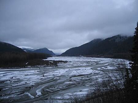
The Klehini River is a large, glacially fed stream in the vicinity of Haines in the U.S. state of Alaska.
The Klehini River is approximately 36 miles long (58 km) from its source in British Columbia to its mouth at the Chilkat River, of which it is the largest tributary. The Klehini River is renowned for its salmon runs, its biannual congregation of bald eagles — the second largest in the Haines area after the Chilkat River's Council Grounds — and for the Klehini Falls, a series of four cataracts near the river’s headwaters. The Klehini also delineates the northern boundary of the Chilkat Range.
The lower Klehini is located within the Alaska Chilkat Bald Eagle Preserve.
Walt Disney's 1991 rendition of White Fang was filmed along the Klehini River.
See also
59°24′42″N 135°55′48″W / 59.41167°N 135.93000°W
