Cherves-Châtelars: Difference between revisions
Appearance
Content deleted Content added
Luckas-bot (talk | contribs) m r2.7.1) (Robot: Adding sv:Cherves-Châtelars |
m r2.6.4) (Robot: Adding sk:Cherves-Châtelars |
||
| Line 94: | Line 94: | ||
[[oc:Cherves Chastelar]] |
[[oc:Cherves Chastelar]] |
||
[[pl:Cherves-Châtelars]] |
[[pl:Cherves-Châtelars]] |
||
[[sk:Cherves-Châtelars]] |
|||
[[sr:Шерв Шатлар]] |
[[sr:Шерв Шатлар]] |
||
[[sv:Cherves-Châtelars]] |
[[sv:Cherves-Châtelars]] |
||
Revision as of 16:36, 24 March 2012
Cherves-Châtelars | |
|---|---|
 | |
| Country | France |
| Region | Nouvelle-Aquitaine |
| Department | Charente |
| Arrondissement | Confolens |
| Canton | Montembœuf |
| Intercommunality | Haute-Charente |
| Government | |
| • Mayor (2008–2014) | Gérard Morand |
Area 1 | 30.68 km2 (11.85 sq mi) |
| Population (2008) | 431 |
| • Density | 14/km2 (36/sq mi) |
| Time zone | UTC+01:00 (CET) |
| • Summer (DST) | UTC+02:00 (CEST) |
| INSEE/Postal code | 16096 /16310 |
| Elevation | 125–313 m (410–1,027 ft) (avg. 234 m or 768 ft) |
| 1 French Land Register data, which excludes lakes, ponds, glaciers > 1 km2 (0.386 sq mi or 247 acres) and river estuaries. | |
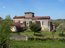
Cherves-Châtelars is a commune in the Charente department in southwestern France.
Population
| Year | 1793 | 1800 | 1806 | 1821 | 1831 | 1841 | 1846 | 1851 | 1856 | 1861 |
|---|---|---|---|---|---|---|---|---|---|---|
| Population | 1173 | 1007 | 1005 | 1297 | 1278 | 1595 | 1689 | 1671 | 1596 | 1505 |
| Year | 1866 | 1872 | 1876 | 1881 | 1886 | 1891 | 1896 | 1901 | 1906 | 1911 |
|---|---|---|---|---|---|---|---|---|---|---|
| Population | 1485 | 1362 | 1395 | 1462 | 1417 | 1421 | 1340 | 1304 | 1305 | 1308 |
| Year | 1921 | 1926 | 1931 | 1936 | 1946 | 1954 | 1962 | 1968 | 1975 | 1982 |
|---|---|---|---|---|---|---|---|---|---|---|
| Population | 1058 | 1031 | 946 | 915 | 869 | 706 | 731 | 656 | 608 | 592 |
| Year | 1990 | 1999 | 2008 |
|---|---|---|---|
| Population | 520 | 443 | 431 |
See also
References

