RAF Kirmington: Difference between revisions
Appearance
Content deleted Content added
m Infobox and structuring |
mNo edit summary |
||
| Line 39: | Line 39: | ||
[[Image:Kirmington - Aircrew Memorial Window.jpg|thumb|left|250px|Stained glass war memorial window in the church of St. Helen, Kirmington.]] |
[[Image:Kirmington - Aircrew Memorial Window.jpg|thumb|left|250px|Stained glass war memorial window in the church of St. Helen, Kirmington.]] |
||
| ⚫ | |||
{| class="wikitable" |
{| class="wikitable" |
||
| Line 80: | Line 79: | ||
From February 1946 the station was put on care and maintenance until relinquished by the [[Air Ministry]] to the [[Ministry of Agriculture, Fisheries and Food|Ministry of Agriculture]] in 1953.<ref name=AS2-121 >[[Bruce Barrymore Halpenny|Halpenny, Bruce Barrymore]] ''Action Stations: Wartime Military Airfields of Lincolnshire and the East Midlands v. 2'' - Page 121</ref> |
From February 1946 the station was put on care and maintenance until relinquished by the [[Air Ministry]] to the [[Ministry of Agriculture, Fisheries and Food|Ministry of Agriculture]] in 1953.<ref name=AS2-121 >[[Bruce Barrymore Halpenny|Halpenny, Bruce Barrymore]] ''Action Stations: Wartime Military Airfields of Lincolnshire and the East Midlands v. 2'' - Page 121</ref> |
||
==Civilian use== |
==Civilian use== |
||
| ⚫ | |||
In 1970, after changing hands several times, Kirmington was selected as the best location for a regional airport serving the [[Kingston upon Hull|Hull]], [[Grimsby]] and [[Scunthorpe]] localities and has become [[Humberside International Airport]].<ref name= "AS2-121"/> |
In 1970, after changing hands several times, Kirmington was selected as the best location for a regional airport serving the [[Kingston upon Hull|Hull]], [[Grimsby]] and [[Scunthorpe]] localities and has become [[Humberside International Airport]].<ref name= "AS2-121"/> |
||
Revision as of 15:50, 3 April 2012
| Royal Air Force station Kirmington | |
|---|---|
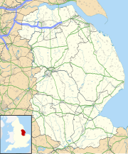
| Located south west of Kirmington, Lincolnshire, England | |
| Coordinates | 53°40′53″N 001°05′00″W / 53.68139°N 1.08333°W |
| Type | Military airfield |
| Site information | |
| Controlled by | Royal Air Force |
| Open to the public | Yes |
| Condition | Intact |
| Site history | |
| Built | 1941 |
| In use | 1942 - 1946 |
| Battles/wars | World War II
|
| Garrison information | |
| Garrison | RAF Bomber Command |
RAF Kirmington was a Royal Air Force Bomber Command station in North Lincolnshire during World War II.[1]
History
It took its name from the village of Kirmington nearby; the most notable squadron based there was 166 Squadron[1] and a memorial plaque to the members of that unit is in the parish church.

| Squadron | Aircraft | Date arrived | Date departed |
|---|---|---|---|
| 150 | Wellington IC and III | October 1942 | January 1943 |
| 142 | Wellington II, III, IV and X | December 1942 | January 1943 |
| 166 | Wellington III | January 1943 | February 1943 |
| Wellington X | February 1943 | September 1943 | |
| Lancaster B I and B III | September 1943 | November 1945 | |
| 153 | Lancaster B I and B III | October 1944 | October 1944 |
After World War II
From February 1946 the station was put on care and maintenance until relinquished by the Air Ministry to the Ministry of Agriculture in 1953.[2]
Civilian use

In 1970, after changing hands several times, Kirmington was selected as the best location for a regional airport serving the Hull, Grimsby and Scunthorpe localities and has become Humberside International Airport.[2]
References
- ^ a b Halpenny, Bruce Barrymore Action Stations: Wartime Military Airfields of Lincolnshire and the East Midlands v. 2 - Page 120
- ^ a b Halpenny, Bruce Barrymore Action Stations: Wartime Military Airfields of Lincolnshire and the East Midlands v. 2 - Page 121
- Halpenny, Bruce Barrymore Action Stations: Wartime Military Airfields of Lincolnshire and the East Midlands v. 2 (1981) (ISBN 978-1852604059)
External links
- Official RAF history
- Map sources for RAF Kirmington
- Memories of Sergeant Roy Keen

