Gornje Košlje: Difference between revisions
Appearance
Content deleted Content added
No edit summary |
No edit summary |
||
| Line 1: | Line 1: | ||
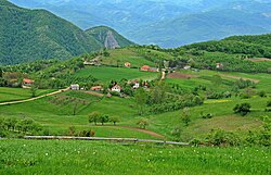
[[Image:Gornje Košlje|250px|thumb|right|Gornje Košlje]] |
[[Image:Gornje Košlje.jpg|250px|thumb|right|Gornje Košlje]] |
||
'''Gornje Košlje''' (Горње Кошље) is a [[village]] in [[Serbia]]. It is situated in the [[Ljubovija]] [[municipality]], in the [[Mačva District]] of [[Central Serbia]]. The village had a [[Serb]] ethnic majority and a population of 649 in 2002. |
'''Gornje Košlje''' (Горње Кошље) is a [[village]] in [[Serbia]]. It is situated in the [[Ljubovija]] [[municipality]], in the [[Mačva District]] of [[Central Serbia]]. The village had a [[Serb]] ethnic majority and a population of 649 in 2002. |
||
Revision as of 02:48, 24 April 2012

Gornje Košlje (Горње Кошље) is a village in Serbia. It is situated in the Ljubovija municipality, in the Mačva District of Central Serbia. The village had a Serb ethnic majority and a population of 649 in 2002.
Historical population
- 1948: 1,258
- 1953: 1,323
- 1961: 1,378
- 1971: 1,103
- 1981: 989
- 1991: 781
- 2002: 649[1]
See also
References
44°09′N 19°34′E / 44.150°N 19.567°E
