Nico Pérez: Difference between revisions
Appearance
Content deleted Content added
rename area code to dial plan using AWB |
→External links: new map |
||
| Line 59: | Line 59: | ||
==External links== |
==External links== |
||
*[http://www.ine.gub.uy/mapas/ |
*[http://www.ine.gub.uy/mapas/censos2011/para%20colgar%20en%20web/pdf/08_UYFD/Localidades/A2H_08724_09521%20Nico%20P%C3%A9rez%20y%20otra.pdf INE map of Nico Pérez and José Batlle y Ordóñez (Florida)] |
||
Revision as of 22:38, 2 September 2012
You can help expand this article with text translated from the corresponding article in Spanish. (June 2011) Click [show] for important translation instructions.
|
Nico Pérez | |
|---|---|
Town | |
| Country | |
| Department | Florida Department |
| Population (2011) | |
• Total | 1,030 |
| Time zone | UTC -3 |
| Postal code | 30200 |
| Dial plan | +598 4469 (+4 digits) |
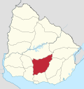
Nico Pérez is a small town (pueblo) in the Florida Department of central Uruguay. It is located on the border of the Lavalleja Department. It is in close proximity to José Batlle y Ordoñez. They are separated partly by Ruta 7 and partly by the railroad tracks. The two parts are joined by a bridge passing over the tracks.
Population
In 2011 Nico Pérez had a population of 1,030.[1]
| Year | Population |
|---|---|
| 1963 | 742 |
| 1975 | 958 |
| 1985 | 580 |
| 1996 | 890 |
| 2004 | 1,049 |
| 2011 | 1,030 |
Source: Instituto Nacional de Estadística de Uruguay[2]
References
- ^ "Censos 2011 Cuadros Florida". INE. 2012. Retrieved 25 August 2012.
- ^ "1963–1996 Statistics / N" (DOC). Instituto Nacional de Estadística de Uruguay. 2004. Retrieved 4 July 2011.
{{cite web}}: Italic or bold markup not allowed in:|publisher=(help)
External links

