|
|
| Line 4: |
Line 4: |
|
*Go to the [[Template:Infobox Swiss town/sandbox|sandbox]] |
|
*Go to the [[Template:Infobox Swiss town/sandbox|sandbox]] |
|
|
|
|
|
|
==[[Ballmoos]] current and former== |
|
|
<table style="background: transparent;"> |
|
|
<tr><th>{{Tl|Municipality}}</th><th>{{Tl|Former Municipality}}</th></tr> |
|
|
<tr><td style="vertical-align: top;"> |
|
|
{{Infobox Swiss town/sandbox |
|
|
| subject_name = Ballmoos |
|
|
| municipality_name = Ballmoos |
|
|
| municipality_type = municipality |
|
|
| imagepath_coa = Ballmoos-coat of arms.svg| |
|
|
| map = |
|
|
| languages = German |
|
|
| canton = Bern |
|
|
| iso-code-region = CH-BE |
|
|
| district = [[Fraubrunnen (district)|Fraubrunnen]] |
|
|
| lat_d=47|lat_m=2|lat_NS=N|long_d=7|long_m=28|long_EW=E |
|
|
| postal_code = 3303 |
|
|
| municipality_code = 0531 |
|
|
| area = 1.5 |
|
|
| elevation = 567|elevation_description= |
|
|
| population = 55|populationof = December 2007 | popofyear = 2007 |
|
|
| website = |
|
|
| mayor = |mayor_asof=|mayor_party= |
|
|
| mayor_title = |list_of_mayors = |
|
|
| places = |
|
|
| demonym = |
|
|
| neighboring_municipalities= [[Deisswil bei Münchenbuchsee]], [[Jegenstorf]], [[Urtenen-Schönbühl]], [[Wiggiswil]], [[Zuzwil, Bern|Zuzwil]] |
|
|
| twintowns = |
|
|
|}} |
|
|
</td><td style="vertical-align: top;"> |
|
|
{{Infobox Swiss town/sandbox |
|
|
| subject_name = Ballmoos |
|
|
| municipality_name = Ballmoos |
|
|
| municipality_type = former |
|
|
| imagepath_coa = Ballmoos-coat of arms.svg| |
|
|
| map = |
|
|
| languages = German |
|
|
| canton = Bern |
|
|
| iso-code-region = CH-BE |
|
|
| district = [[Fraubrunnen (district)|Fraubrunnen]] |
|
|
| lat_d=47|lat_m=2|lat_NS=N|long_d=7|long_m=28|long_EW=E |
|
|
| postal_code = 3303 |
|
|
| municipality_code = 0531 |
|
|
| area = 1.5 |
|
|
| elevation = 567|elevation_description= |
|
|
| population = 55|populationof = December 2007 | popofyear = 2007 |
|
|
| website = |
|
|
| mayor = |mayor_asof=|mayor_party= |
|
|
| mayor_title = |list_of_mayors = |
|
|
| places = |
|
|
| demonym = |
|
|
| neighboring_municipalities= [[Deisswil bei Münchenbuchsee]], [[Jegenstorf]], [[Urtenen-Schönbühl]], [[Wiggiswil]], [[Zuzwil, Bern|Zuzwil]] |
|
|
| twintowns = |
|
|
|}} |
|
|
</td></tr></table> |
|
==[[Aquila, Switzerland]]== |
|
==[[Aquila, Switzerland]]== |
|
<table style="background: transparent;"> |
|
<table style="background: transparent;"> |
| {{Infobox Swiss town}} | {{Infobox Swiss town/sandbox}} |
|---|
Aarau |
|---|
|
 Coat of arms | | Country | Switzerland |
|---|
| Canton | Aargau |
|---|
| District | Aarau |
|---|
|
| • Mayor | Marcel Guignard FDP/PRD
(as of 2004) |
|---|
|
• Total | 8.94 km2 (3.45 sq mi) |
|---|
| Elevation | 381 m (1,250 ft) |
|---|
| Highest elevation | 471 m (1,545 ft) |
|---|
| Lowest elevation | 365 m (1,198 ft) |
|---|
|
• Total | 15,619 |
|---|
| • Density | 1,700/km2 (4,500/sq mi) |
|---|
| Time zone | UTC+01:00 (Central European Time) |
|---|
| • Summer (DST) | UTC+02:00 (Central European Summer Time) |
|---|
| Postal code(s) | 5000 |
|---|
| SFOS number | 4001 |
|---|
| ISO 3166 code | CH-AG |
|---|
| Surrounded by | Rohr, Buchs, Suhr, Unterentfelden, Eppenberg-Wöschnau, Erlinsbach |
|---|
| Twin towns | Neuchâtel (Switzerland), Delft (Netherlands), Reutlingen (Germany) |
|---|
| Website | www.aarau.ch
SFSO statistics |
|---|
|
Aarau |
|---|
|
 Coat of arms | | Country | Switzerland |
|---|
| Canton | Aargau |
|---|
| District | Aarau |
|---|
|
| • Mayor | Marcel Guignard FDP/PRD
(as of 2004) |
|---|
|
• Total | 8.94 km2 (3.45 sq mi) |
|---|
| Elevation | 381 m (1,250 ft) |
|---|
| Highest elevation | 471 m (1,545 ft) |
|---|
| Lowest elevation | 365 m (1,198 ft) |
|---|
|
• Total | 15,619 |
|---|
| • Density | 1,700/km2 (4,500/sq mi) |
|---|
| Time zone | UTC+01:00 (Central European Time) |
|---|
| • Summer (DST) | UTC+02:00 (Central European Summer Time) |
|---|
| Postal code(s) | 5000 |
|---|
| SFOS number | 4001 |
|---|
| ISO 3166 code | CH-AG |
|---|
| Surrounded by | Rohr, Buchs, Suhr, Unterentfelden, Eppenberg-Wöschnau, Erlinsbach |
|---|
| Twin towns | Neuchâtel (Switzerland), Delft (Netherlands), Reutlingen (Germany) |
|---|
| Website | www.aarau.ch
SFSO statistics |
|---|
|
| {{Infobox Swiss town}} | {{Infobox Swiss town/sandbox}} |
|---|
Bern |
|---|
|
 | |
| | Country | Switzerland |
|---|
| Canton | Bern |
|---|
| District | Bern |
|---|
|
| • Mayor (list) | Alexander Tschäppät SPS/PSS
(as of 2005) |
|---|
|
• Total | 52 km2 (20 sq mi) |
|---|
| Elevation | 542 m (1,778 ft) |
|---|
| Highest elevation | 674 m (2,211 ft) |
|---|
| Lowest elevation | 480 m (1,570 ft) |
|---|
|
• Total | 128,041 |
|---|
| • Density | 2,500/km2 (6,400/sq mi) |
|---|
| Demonym | Berner |
|---|
| Time zone | UTC+01:00 (Central European Time) |
|---|
| • Summer (DST) | UTC+02:00 (Central European Summer Time) |
|---|
| Postal code(s) | 3000 |
|---|
| SFOS number | 0351 |
|---|
| ISO 3166 code | CH-BE |
|---|
| Surrounded by | Bremgarten bei Bern, Frauenkappelen, Ittigen, Kirchlindach, Köniz, Mühleberg, Muri bei Bern, Neuenegg, Ostermundigen, Wohlen bei Bern, Zollikofen |
|---|
| Twin towns | Salzburg (Austria) |
|---|
| Website | www.bern.ch
SFSO statistics |
|---|
|
Bern |
|---|
|
 | |
| | Country | Switzerland |
|---|
| Canton | Bern |
|---|
| District | Bern |
|---|
|
| • Mayor (list) | Alexander Tschäppät SPS/PSS
(as of 2005) |
|---|
|
• Total | 52 km2 (20 sq mi) |
|---|
| Elevation | 542 m (1,778 ft) |
|---|
| Highest elevation | 674 m (2,211 ft) |
|---|
| Lowest elevation | 480 m (1,570 ft) |
|---|
|
• Total | 128,041 |
|---|
| • Density | 2,500/km2 (6,400/sq mi) |
|---|
| Demonym | Berner |
|---|
| Time zone | UTC+01:00 (Central European Time) |
|---|
| • Summer (DST) | UTC+02:00 (Central European Summer Time) |
|---|
| Postal code(s) | 3000 |
|---|
| SFOS number | 0351 |
|---|
| ISO 3166 code | CH-BE |
|---|
| Surrounded by | Bremgarten bei Bern, Frauenkappelen, Ittigen, Kirchlindach, Köniz, Mühleberg, Muri bei Bern, Neuenegg, Ostermundigen, Wohlen bei Bern, Zollikofen |
|---|
| Twin towns | Salzburg (Austria) |
|---|
| Website | www.bern.ch
SFSO statistics |
|---|
|
[Zwischbergen]]
| {{Infobox Swiss town}} | {{Infobox Swiss town/sandbox}} | {{Infobox settlement}} |
|---|
Lausanne |
|---|
|
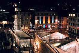
 Europe square by night |
 Coat of arms | | Country | Switzerland |
|---|
| Canton | Vaud |
|---|
| District | Lausanne |
|---|
|
| • Mayor | Syndic (list)
Daniel Brélaz GPS
(as of 2007) |
|---|
|
• Total | 41.37 km2 (15.97 sq mi) |
|---|
| Elevation (375 m - 900 m) | 495 m (1,624 ft) |
|---|
|
• Total | 128,302 |
|---|
| • Density | 3,100/km2 (8,000/sq mi) |
|---|
| Demonym | Les Lausannois |
|---|
| Time zone | UTC+01:00 (Central European Time) |
|---|
| • Summer (DST) | UTC+02:00 (Central European Summer Time) |
|---|
| Postal code(s) | 1000-1018 |
|---|
| SFOS number | 5586 |
|---|
| ISO 3166 code | CH-VD |
|---|
| Localities | Le Chalet-à-Gobet, Montblesson, Montheron, Ouchy, Vernand-Dessous, Vernand-Dessus, Vers-chez-les-Blanc |
|---|
| Surrounded by | Bottens, Bretigny-sur-Morrens, Chavannes-près-Renens, Cheseaux-sur-Lausanne, Crissier, Cugy, Ecublens, Epalinges, Évian-les-Bains (FR-74), Froideville, Jouxtens-Mézery, Le Mont-sur-Lausanne, Lugrin (FR-74), Maxilly-sur-Léman (FR-74), Montpreveyres, Morrens, Neuvecelle (FR-74), Prilly, Pully, Renens, Romanel-sur-Lausanne, Saint-Sulpice, Savigny |
|---|
| Website | www.lausanne.ch
Profile (in French), SFSO statistics |
|---|
|
Lausanne |
|---|
|
 Europe square by night |
 Coat of arms | | Country | Switzerland |
|---|
| Canton | Vaud |
|---|
| District | Lausanne |
|---|
|
| • Mayor | Syndic (list)
Daniel Brélaz GPS
(as of 2007) |
|---|
|
• Total | 41.37 km2 (15.97 sq mi) |
|---|
| Elevation (375 m - 900 m) | 495 m (1,624 ft) |
|---|
|
• Total | 128,302 |
|---|
| • Density | 3,100/km2 (8,000/sq mi) |
|---|
| Demonym | Les Lausannois |
|---|
| Time zone | UTC+01:00 (Central European Time) |
|---|
| • Summer (DST) | UTC+02:00 (Central European Summer Time) |
|---|
| Postal code(s) | 1000-1018 |
|---|
| SFOS number | 5586 |
|---|
| ISO 3166 code | CH-VD |
|---|
| Localities | Le Chalet-à-Gobet, Montblesson, Montheron, Ouchy, Vernand-Dessous, Vernand-Dessus, Vers-chez-les-Blanc |
|---|
| Surrounded by | Bottens, Bretigny-sur-Morrens, Chavannes-près-Renens, Cheseaux-sur-Lausanne, Crissier, Cugy, Ecublens, Epalinges, Évian-les-Bains (FR-74), Froideville, Jouxtens-Mézery, Le Mont-sur-Lausanne, Lugrin (FR-74), Maxilly-sur-Léman (FR-74), Montpreveyres, Morrens, Neuvecelle (FR-74), Prilly, Pully, Renens, Romanel-sur-Lausanne, Saint-Sulpice, Savigny |
|---|
| Website | www.lausanne.ch
Profile (in French), SFSO statistics |
|---|
|
Lausanne |
|---|
 Europe square by night |
 Coat of arms | | Country | Switzerland |
|---|
| Canton | Vaud |
|---|
| District | Lausanne |
|---|
| Localities | Le Chalet-à-Gobet, Montblesson, Ouchy, Vernand-Dessous, Vernand-Dessus, Vers-chez-les-Blanc |
|---|
|
| • Mayor | Daniel Brélaz (GPS) |
|---|
|
• Total | 41.37 km2 (15.97 sq mi) |
|---|
| Elevation 375 m - 900 m | 495 m (1,624 ft) |
|---|
|
• Total | 128,302 |
|---|
| • Urban density | 3,101/km2 (8,030/sq mi) |
|---|
| Postal code | 1000-1018 |
|---|
| SFOS number | 5586 |
|---|
| Surrounded by | Bottens, Bretigny-sur-Morrens, Chavannes-près-Renens, Cheseaux-sur-Lausanne, Crissier, Cugy, Ecublens, Epalinges, Évian-les-Bains (FR-74), Froideville, Jouxtens-Mézery, Le Mont-sur-Lausanne, Lugrin (FR-74), Maxilly-sur-Léman (FR-74), Montpreveyres, Morrens, Neuvecelle (FR-74), Prilly, Pully, Renens, Romanel-sur-Lausanne, Saint-Sulpice, Savigny |
|---|
| Website | www.lausanne.ch |
|---|
|
References
References
These references will appear in the article, but this list appears only on this page.


